Faku County
Faku County .mw-parser-output .nobold{font-weight:normal} 法库县 | ||||||||||||||||||||||||||||||||||||||||||
|---|---|---|---|---|---|---|---|---|---|---|---|---|---|---|---|---|---|---|---|---|---|---|---|---|---|---|---|---|---|---|---|---|---|---|---|---|---|---|---|---|---|---|
County | ||||||||||||||||||||||||||||||||||||||||||
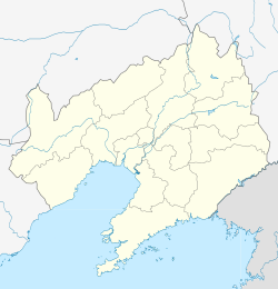 Faku Location in Liaoning | ||||||||||||||||||||||||||||||||||||||||||
| Coordinates: 42°29′42″N 123°24′40″E / 42.495°N 123.411°E / 42.495; 123.411Coordinates: 42°29′42″N 123°24′40″E / 42.495°N 123.411°E / 42.495; 123.411[1] | ||||||||||||||||||||||||||||||||||||||||||
| Country | People's Republic of China | |||||||||||||||||||||||||||||||||||||||||
| Province | Liaoning | |||||||||||||||||||||||||||||||||||||||||
| Sub-provincial city | Shenyang | |||||||||||||||||||||||||||||||||||||||||
| Area [2] | ||||||||||||||||||||||||||||||||||||||||||
| • Total | 2,285 km2 (882 sq mi) | |||||||||||||||||||||||||||||||||||||||||
| Population (2010) | ||||||||||||||||||||||||||||||||||||||||||
| • Total | 399,587 | |||||||||||||||||||||||||||||||||||||||||
| • Density | 170/km2 (450/sq mi) | |||||||||||||||||||||||||||||||||||||||||
| Time zone | UTC+8 (China Standard) | |||||||||||||||||||||||||||||||||||||||||
| Postal code | 1104XX | |||||||||||||||||||||||||||||||||||||||||
| Shenyang district map |
| |||||||||||||||||||||||||||||||||||||||||

Faku County (simplified Chinese: 法库县; traditional Chinese: 法庫縣; pinyin: Fǎkù Xiàn) is under the administration of Shenyang, the capital of Liaoning province, People's Republic of China, 77 km (48 mi) north of downtown Shenyang. As of 2010[update], it has a population of 399,587 in an area of 2,285 km2 (882 sq mi). It lies on China National Highway 203. It borders Kangping County to the north, Shenbei New Area to the southeast, and Xinmin City to the southwest as well as the prefecture-level cities of Tieling to the east and Fuxin to the west.
Administrative divisions
There are 8 towns, 11 townships, and 1 ethnic township within the county.[3]
Towns:
| Townships:
|
References
^ Google (2014-07-02). "Faku" (Map). Google Maps. Google. Retrieved 2014-07-02..mw-parser-output cite.citation{font-style:inherit}.mw-parser-output q{quotes:"""""""'""'"}.mw-parser-output code.cs1-code{color:inherit;background:inherit;border:inherit;padding:inherit}.mw-parser-output .cs1-lock-free a{background:url("//upload.wikimedia.org/wikipedia/commons/thumb/6/65/Lock-green.svg/9px-Lock-green.svg.png")no-repeat;background-position:right .1em center}.mw-parser-output .cs1-lock-limited a,.mw-parser-output .cs1-lock-registration a{background:url("//upload.wikimedia.org/wikipedia/commons/thumb/d/d6/Lock-gray-alt-2.svg/9px-Lock-gray-alt-2.svg.png")no-repeat;background-position:right .1em center}.mw-parser-output .cs1-lock-subscription a{background:url("//upload.wikimedia.org/wikipedia/commons/thumb/a/aa/Lock-red-alt-2.svg/9px-Lock-red-alt-2.svg.png")no-repeat;background-position:right .1em center}.mw-parser-output .cs1-subscription,.mw-parser-output .cs1-registration{color:#555}.mw-parser-output .cs1-subscription span,.mw-parser-output .cs1-registration span{border-bottom:1px dotted;cursor:help}.mw-parser-output .cs1-hidden-error{display:none;font-size:100%}.mw-parser-output .cs1-visible-error{font-size:100%}.mw-parser-output .cs1-subscription,.mw-parser-output .cs1-registration,.mw-parser-output .cs1-format{font-size:95%}.mw-parser-output .cs1-kern-left,.mw-parser-output .cs1-kern-wl-left{padding-left:0.2em}.mw-parser-output .cs1-kern-right,.mw-parser-output .cs1-kern-wl-right{padding-right:0.2em}
^ 分地区土地面积和人口密度 (2012年末) (in Chinese). Shenyang Statistics Bureau. Retrieved 6 July 2014.
^ 2011年统计用区划代码和城乡划分代码:法库县 (in Chinese). National Bureau of Statistics of the People's Republic of China. Archived from the original on 2012-12-08. Retrieved 2012-07-17.
External links
This Liaoning location article is a stub. You can help Wikipedia by expanding it. |


