大口環道
body.skin-minerva .mw-parser-output table.infobox caption{text-align:center}
Sandy Bay Road 大口環道 | |
|---|---|
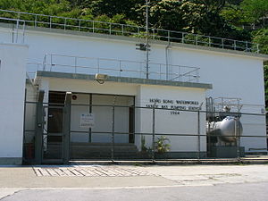 座落於大口環道的大口環抽水站 | |
| 基本資料 | |
| 總長度 | 0.8公里 |
| 車速限制 | 50公里/小時 |
| 行車線數目 | 雙線雙程(東段) 單線單程(西段) |
| 所在地區 | 南區沙灣 |
| 起點 | 域多利道 |
| 終點 | 域多利道 |
大口環道(Sandy Bay Road)是香港的一條道路,位於港島薄扶林沙灣(大口環)。道路呈U形,兩端連接域多利道,南面則與沙灣徑交匯。
鄰近設施
- 大口環根德公爵夫人兒童醫院
- 東華三院馮堯敬醫院
- 東華三院賽馬會護理安老院
- 香港紅十字會甘迺迪中心
英基學校協會西島中學
協康會慶華中心
- 東華義莊
公共交通
交通路線列表
港島專線小巴
10 | 銅鑼灣(謝斐道) | ⇄ | 數碼港 | |
10P | 銅鑼灣(謝斐道) | ⇄ | 數碼港 | 只限平日繁忙時間服務 |
58 | 香港仔(湖南街) | ⇄ | 堅尼地城站 | |
58A | 香港仔(湖南街) | ⇄ | 堅尼地城站 | |
58M | 貝沙灣南灣 | ↺ | 堅尼地城站 | |
59 | 堅尼地城站 | ⇄ | 深灣 | 只限平日繁忙時間服務 |
| 这是一篇與香港道路相關的小作品。你可以通过编辑或修订扩充其内容。 |


