Jiroft County
Jiroft County Ŝahrestāne Jiroft | |
|---|---|
County | |
 Location in Kerman Province | |
 Location of Kerman Province in Iran | |
| Coordinates: 28°50′N 57°35′E / 28.833°N 57.583°E / 28.833; 57.583Coordinates: 28°50′N 57°35′E / 28.833°N 57.583°E / 28.833; 57.583 | |
| Country | |
| Province | Kerman |
| Capital | Jiroft |
Bakhsh (Districts) | Central District, Sarduiyeh District, Jebalbarez District |
| Population (2006) | |
| • Total | 181,300 |
| Time zone | UTC+3:30 (IRST) |
| • Summer (DST) | UTC+4:30 (IRDT) |
| Jiroft County can be found at GEOnet Names Server, at this link, by opening the Advanced Search box, entering "9206661" in the "Unique Feature Id" form, and clicking on "Search Database". | |
Jiroft County (Persian: Ŝahrestāne Jiroft) is a county in Kerman Province in Iran. The capital of the county is Jiroft. At the 2006 census, the county's population was 181,300 in 38,307 families.[1] The county is subdivided into three districts (bakhsh): the Central District, Sarduiyeh District, and Jebalbarez District. The county has three cities: Jiroft, Darb-e Behesht, Jebalbarez & Boluk.
Gallery

Jiroft County
Ruins, Jiroft County

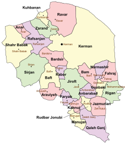
Jiroft Map


References
^ "Census of the Islamic Republic of Iran, 1385 (2006)". Islamic Republic of Iran. Archived from the original (Excel) on 2011-11-11..mw-parser-output cite.citation{font-style:inherit}.mw-parser-output .citation q{quotes:"""""""'""'"}.mw-parser-output .citation .cs1-lock-free a{background:url("//upload.wikimedia.org/wikipedia/commons/thumb/6/65/Lock-green.svg/9px-Lock-green.svg.png")no-repeat;background-position:right .1em center}.mw-parser-output .citation .cs1-lock-limited a,.mw-parser-output .citation .cs1-lock-registration a{background:url("//upload.wikimedia.org/wikipedia/commons/thumb/d/d6/Lock-gray-alt-2.svg/9px-Lock-gray-alt-2.svg.png")no-repeat;background-position:right .1em center}.mw-parser-output .citation .cs1-lock-subscription a{background:url("//upload.wikimedia.org/wikipedia/commons/thumb/a/aa/Lock-red-alt-2.svg/9px-Lock-red-alt-2.svg.png")no-repeat;background-position:right .1em center}.mw-parser-output .cs1-subscription,.mw-parser-output .cs1-registration{color:#555}.mw-parser-output .cs1-subscription span,.mw-parser-output .cs1-registration span{border-bottom:1px dotted;cursor:help}.mw-parser-output .cs1-ws-icon a{background:url("//upload.wikimedia.org/wikipedia/commons/thumb/4/4c/Wikisource-logo.svg/12px-Wikisource-logo.svg.png")no-repeat;background-position:right .1em center}.mw-parser-output code.cs1-code{color:inherit;background:inherit;border:inherit;padding:inherit}.mw-parser-output .cs1-hidden-error{display:none;font-size:100%}.mw-parser-output .cs1-visible-error{font-size:100%}.mw-parser-output .cs1-maint{display:none;color:#33aa33;margin-left:0.3em}.mw-parser-output .cs1-subscription,.mw-parser-output .cs1-registration,.mw-parser-output .cs1-format{font-size:95%}.mw-parser-output .cs1-kern-left,.mw-parser-output .cs1-kern-wl-left{padding-left:0.2em}.mw-parser-output .cs1-kern-right,.mw-parser-output .cs1-kern-wl-right{padding-right:0.2em}
- Atlase Gitāŝenāsiye Ostānhāye Irān [Atlas Gitashenasi Ostanhai Iran] (Gitashenasi Province Atlas of Iran)
External links
| Wikimedia Commons has media related to Jiroft county. |
| Capital |
|  | |||||||||||||||||||||||||||||||||||||||||||||
|---|---|---|---|---|---|---|---|---|---|---|---|---|---|---|---|---|---|---|---|---|---|---|---|---|---|---|---|---|---|---|---|---|---|---|---|---|---|---|---|---|---|---|---|---|---|---|---|
Counties and cities |
| ||||||||||||||||||||||||||||||||||||||||||||||
| Sights |
| ||||||||||||||||||||||||||||||||||||||||||||||
| Places |
| ||||||||||||||||||||||||||||||||||||||||||||||
| Capital |
| ||||||||||||||||||||||||||||||||||||||||
|---|---|---|---|---|---|---|---|---|---|---|---|---|---|---|---|---|---|---|---|---|---|---|---|---|---|---|---|---|---|---|---|---|---|---|---|---|---|---|---|---|---|
| Districts |
| ||||||||||||||||||||||||||||||||||||||||
This Jiroft County location article is a stub. You can help Wikipedia by expanding it. |


