Calderbank

Calderbank at sunset.
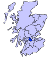
Calderbank is a village outside the town of Airdrie, North Lanarkshire, Scotland.[1] It lies west of the M73, on the west bank of the North Calder Water. The village lies 13 miles east of Glasgow city centre and around 34 miles west of Edinburgh. Other nearby towns include: Airdrie (2.5 miles), Coatbridge (4 miles), Bellshill (4 miles) and Motherwell (5 miles). It has a population of about 1,610.[2]
Contents
1 Etymology
2 History
3 References
4 Bibliography
5 External links
Etymology
The village's name is of a doubtful etymology. The first part of the name refers to the River Calder that flows through the village: however the second element is unknown.[3] Some sources suggest the second element is from Old English benc "bench". A record of the name from 1182 as Celdrebec suggests this.
History
The village is famous for being the birthplace of the Vulcan, the world's first iron boat, which sailed from Calderbanks Iron Works to the River Clyde and plied the Scottish canals first with passengers and then with cargoes of iron and coal.

Iron from the Calderbanks works was used to build the Queen Mary cruise liner. The Monkland Canal was extended to the west of the village in the late 18th century and was used as a route to transport coal to Port Dundas in Glasgow 12 miles away. This part of the canal has been preserved between the village and Sikeside on the outskirts of Coatbridge.And other parts of the canal can be seen in Coatbridge town centre and Drumpelier country park,however much of the canal was covered in the 1950s and 1960s by the M8 motorway which actually runs with the meanders of what was the canal (yet under the motorway large pipes still run water which feed the Forth and Clyde canal today).
Calderbank was the site of early Christian settlement, by monks from Newbattle Abbey in the Borders. This gave the local area the name of Monklands.
References
^ "O.S. Map with zoom and Bing overlay". National Library of Scotland. Ordnance Survey. Retrieved 30 December 2017..mw-parser-output cite.citation{font-style:inherit}.mw-parser-output .citation q{quotes:"""""""'""'"}.mw-parser-output .citation .cs1-lock-free a{background:url("//upload.wikimedia.org/wikipedia/commons/thumb/6/65/Lock-green.svg/9px-Lock-green.svg.png")no-repeat;background-position:right .1em center}.mw-parser-output .citation .cs1-lock-limited a,.mw-parser-output .citation .cs1-lock-registration a{background:url("//upload.wikimedia.org/wikipedia/commons/thumb/d/d6/Lock-gray-alt-2.svg/9px-Lock-gray-alt-2.svg.png")no-repeat;background-position:right .1em center}.mw-parser-output .citation .cs1-lock-subscription a{background:url("//upload.wikimedia.org/wikipedia/commons/thumb/a/aa/Lock-red-alt-2.svg/9px-Lock-red-alt-2.svg.png")no-repeat;background-position:right .1em center}.mw-parser-output .cs1-subscription,.mw-parser-output .cs1-registration{color:#555}.mw-parser-output .cs1-subscription span,.mw-parser-output .cs1-registration span{border-bottom:1px dotted;cursor:help}.mw-parser-output .cs1-ws-icon a{background:url("//upload.wikimedia.org/wikipedia/commons/thumb/4/4c/Wikisource-logo.svg/12px-Wikisource-logo.svg.png")no-repeat;background-position:right .1em center}.mw-parser-output code.cs1-code{color:inherit;background:inherit;border:inherit;padding:inherit}.mw-parser-output .cs1-hidden-error{display:none;font-size:100%}.mw-parser-output .cs1-visible-error{font-size:100%}.mw-parser-output .cs1-maint{display:none;color:#33aa33;margin-left:0.3em}.mw-parser-output .cs1-subscription,.mw-parser-output .cs1-registration,.mw-parser-output .cs1-format{font-size:95%}.mw-parser-output .cs1-kern-left,.mw-parser-output .cs1-kern-wl-left{padding-left:0.2em}.mw-parser-output .cs1-kern-right,.mw-parser-output .cs1-kern-wl-right{padding-right:0.2em}
^ "Estimated population of localities by broad age groups, mid-2012" (PDF). Retrieved 3 January 2018.
^ Drummond, Peter, John (2014). An analysis of toponyms and toponymic patterns in eight parishes of the upper Kelvin basin (PDF). Glasgow: Glasgow University. p. 387. Retrieved 3 July 2017.
Bibliography
Calderbank : an industrial and social history[1]
External links
![]() Media related to Calderbank at Wikimedia Commons
Media related to Calderbank at Wikimedia Commons
Coordinates: 55°50′35″N 3°58′06″W / 55.84306°N 3.96833°W / 55.84306; -3.96833
This North Lanarkshire location article is a stub. You can help Wikipedia by expanding it. |
^ Duncan, Robert (1984). Calderbank : an industrial and social history. Monklands Library Services Department. Retrieved 3 January 2018.
