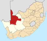
Postmasburg
Postmasburg | |
|---|---|
 Postmasburg Show map of Northern Cape  Postmasburg Postmasburg (South Africa) Show map of South Africa  Postmasburg Postmasburg (Africa) Show map of Africa | |
| Coordinates: 28°19′40″S 23°04′14″E / 28.3279°S 23.0706°E / -28.3279; 23.0706Coordinates: 28°19′40″S 23°04′14″E / 28.3279°S 23.0706°E / -28.3279; 23.0706 | |
| Country | South Africa |
| Province | Northern Cape |
| District | ZF Mgcawu |
| Municipality | Tsantsabane |
| Established | 1892 |
| Area [1] | |
| • Total | 158.41 km2 (61.16 sq mi) |
| Population (2011)[1] | |
| • Total | 30,089 |
| • Density | 190/km2 (490/sq mi) |
| Racial makeup (2011) [1] | |
| • Black African | 54.6% |
| • Coloured | 36.8% |
| • Indian/Asian | 0.5% |
| • White | 7.4% |
| • Other | 0.7% |
First languages (2011) [1] | |
| • Afrikaans | 53.9% |
| • Tswana | 33.6% |
| • Xhosa | 2.7% |
| • Sotho | 2.6% |
| • Other | 7.2% |
| Time zone | UTC+2 (SAST) |
Postal code (street) | 8420 |
| PO box | 8420 |
| Area code | 053 |
Postmasburg is a town in the Northern Cape province of South Africa, located approximately 170 km east of Upington.[2]
Town 67 km (42 mi) north of Griquatown and 58 km (36 mi) west-south-west of Daniëlskuil. Originally a station of the London Missionary Society called Sibiling, it became a Griqua village with the name Blinkklip. It was proclaimed a town on 6 June 1892 and named after the Reverend Dirk Postma (1818-1890), founder of the Reformed Church.[3]
The town achieved municipal status in 1936.
The South African Army's Combat Training Centre is located nearby, at Lohatla
See also
- Redstone Solar Thermal Power
- Jasper Solar Energy Project
- Lesedi Solar Park
References
^ abcd "Main Place Postmasburg". Census 2011..mw-parser-output cite.citation{font-style:inherit}.mw-parser-output q{quotes:"""""""'""'"}.mw-parser-output code.cs1-code{color:inherit;background:inherit;border:inherit;padding:inherit}.mw-parser-output .cs1-lock-free a{background:url("//upload.wikimedia.org/wikipedia/commons/thumb/6/65/Lock-green.svg/9px-Lock-green.svg.png")no-repeat;background-position:right .1em center}.mw-parser-output .cs1-lock-limited a,.mw-parser-output .cs1-lock-registration a{background:url("//upload.wikimedia.org/wikipedia/commons/thumb/d/d6/Lock-gray-alt-2.svg/9px-Lock-gray-alt-2.svg.png")no-repeat;background-position:right .1em center}.mw-parser-output .cs1-lock-subscription a{background:url("//upload.wikimedia.org/wikipedia/commons/thumb/a/aa/Lock-red-alt-2.svg/9px-Lock-red-alt-2.svg.png")no-repeat;background-position:right .1em center}.mw-parser-output .cs1-subscription,.mw-parser-output .cs1-registration{color:#555}.mw-parser-output .cs1-subscription span,.mw-parser-output .cs1-registration span{border-bottom:1px dotted;cursor:help}.mw-parser-output .cs1-hidden-error{display:none;font-size:100%}.mw-parser-output .cs1-visible-error{font-size:100%}.mw-parser-output .cs1-subscription,.mw-parser-output .cs1-registration,.mw-parser-output .cs1-format{font-size:95%}.mw-parser-output .cs1-kern-left,.mw-parser-output .cs1-kern-wl-left{padding-left:0.2em}.mw-parser-output .cs1-kern-right,.mw-parser-output .cs1-kern-wl-right{padding-right:0.2em}
^ "Postmasburg". northerncape.org.za. Retrieved 2009-03-27.
^ "Dictionary of Southern African Place Names (Public Domain)". Human Science Research Council. p. 374.
This Northern Cape location article is a stub. You can help Wikipedia by expanding it. |
