Mahomet, Illinois
Mahomet | |
|---|---|
Village | |
 Lake of the Woods, Mahomet, Illinois | |
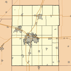
 Location of Mahomet in Champaign County, Illinois. | |
 Mahomet Location within Champaign County Show map of Champaign County, Illinois  Mahomet Mahomet (Illinois) Show map of Illinois | |
| Coordinates: 40°11′33″N 88°24′8″W / 40.19250°N 88.40222°W / 40.19250; -88.40222Coordinates: 40°11′33″N 88°24′8″W / 40.19250°N 88.40222°W / 40.19250; -88.40222 | |
| Country | United States |
| State | Illinois |
| County | Champaign |
| Area [2] | |
| • Total | 9.54 sq mi (24.72 km2) |
| • Land | 9.48 sq mi (24.55 km2) |
| • Water | 0.07 sq mi (0.17 km2) |
| Elevation | 715 ft (218 m) |
| Population (2010) | |
| • Total | 7,258 |
| • Estimate (2016)[1] | 8,287 |
| • Density | 874.16/sq mi (337.52/km2) |
| Time zone | UTC-6 (CST) |
| • Summer (DST) | UTC-5 (CDT) |
| Postal code | 61853 |
| Area code(s) | 217 |
| FIPS code | 17-46136 |
| Website | www.mahomet-il.gov |
Mahomet /məˈhɒmɪt/ is a town in Champaign County, Illinois, United States. The population was 7,258 at the 2010 census. Mahomet is located approximately ten miles northwest of Champaign at the junction of Interstate 74 and IL 47.
Contents
1 Geography
2 Demographics
3 Forest preserves
4 Mahomet schools
5 History
6 Points of interest
7 Notes
8 External links
Geography
Mahomet is located at 40°11′33″N 88°24′8″W / 40.19250°N 88.40222°W / 40.19250; -88.40222 (40.192384, -88.402115).[3]
According to the 2010 census, Mahomet has a total area of 9.086 square miles (23.53 km2), of which 9.02 square miles (23.36 km2) (or 99.27%) is land and 0.066 square miles (0.17 km2) (or 0.73%) is water.[4]
Demographics
@media all and (max-width:720px){.mw-parser-output .mobile-float-reset{float:none!important;width:100%!important}}.mw-parser-output .stack-container{box-sizing:border-box}.mw-parser-output .stack-clear-left{float:left;clear:left}.mw-parser-output .stack-clear-right{float:right;clear:right}.mw-parser-output .stack-left{float:left}.mw-parser-output .stack-right{float:right}.mw-parser-output .stack-object{margin:1px;overflow:hidden}

The Early American Museum at Lake of the Woods forest preserve.[6]
As of the census[7] of 2000, there were 4,877 people, 1,654 households, and 1,374 families residing in the village. This figure does not include surrounding subdivisions which would almost double the population. The population density was 711.6 people per square mile (274.9/km²). There were 1,700 housing units at an average density of 248.0 per square mile (95.8/km²). The racial makeup of the village was 98.18% White, 0.14% African American, 0.10% Native American, 0.59% Asian, 0.39% from other races, and 0.59% from two or more races. Hispanic or Latino of any race were 0.94% of the population.
There were 1,654 households out of which 51.3% had children under the age of 18 living with them, 70.9% were married couples living together, 9.4% had a female householder with no husband present, and 16.9% were non-families. 14.1% of all households were made up of individuals and 6.0% had someone living alone who was 65 years of age or older. The average household size was 2.95 and the average family size was 3.27.
In the village, the population was spread out with 34.3% under the age of 18, 6.4% from 18 to 24, 31.8% from 25 to 44, 20.6% from 45 to 64, and 6.9% who were 65 years of age or older. The median age was 34 years. For every 100 females, there were 93.4 males. For every 100 females age 18 and over, there were 88.0 males.
The median income for a household in the village was $57,574, and the median income for a family was $61,063. Males had a median income of $46,277 versus $30,956 for females. The per capita income for the village was $21,990. About 3.5% of families and 5.1% of the population were below the poverty line, including 5.1% of those under age 18 and 3.9% of those age 65 or over.
As of 2010 Mahomet had a population of 7,258. The ethnic and racial composition of the population was 95.9% white, 0.6% African-American, 0.2% Native American, 1.8% Asian, 0.4% reporting some other race and 1.1% reporting two or more races. 2.0% of the population was Hispanic or Latino.[8]
Forest preserves

"HI Tower"[9] at the Champaign County Forest Preserve District Headquarters in Lake of the Woods Forest Preserve, Mahomet, Illinois.
The most popular tourist attractions in Mahomet are all Champaign County Forest Preserve District properties: Lake of the Woods Park and its award-winning Hartwell C. Howard Golf Course, and the River Bend Forest Preserve. Lake of the Woods Forest Preserve is a 900 acres (3.6 km2) park along the Sangamon River. The park features a botanical garden, a lake, a picturesque covered bridge and also offers activities like boating, fishing, cross country skiing, and sledding. Within Lake of the Woods Park is the Museum of the Grand Prairie (formerly called the Early American Museum), which has a collection that features life in the 19th and early 20th century in East-Central Illinois. The park has a 3.3-mile (5.3 km) bike path and a bell tower. The Hartwell C. Howard Golf Course is an 18-hole regulation course, a 9-hole par 3 course, and a practice range. The River Bend Forest Preserve is 275 acres (1.11 km2), of which 130 acres (0.53 km2) is water. The park has two large lakes, one of them being the largest lake in Champaign County and 2.5 miles (4.0 km) of forest along the Sangamon River.
Mahomet schools
The Mahomet School District has 2,980 students and 183 instructors spread over five schools.[10]
History

Lake of the Woods forest preserve covered bridge.[11]
The village of Mahomet was first settled in 1832 on the banks of the Sangamon River. It was the first community to be established in modern-day Champaign County. The original village name was Middletown, possibly because it is half-way between the towns of Danville and Bloomington.[12] In 1871, the name of the village was changed to Mahomet because there was already another Middletown in Illinois, which was causing mail problems.[13] Most early settlers came from Ohio, Virginia, Kentucky, and Pennsylvania and chose to reside in Mahomet because there was abundant water from the Sangamon River and abundant trees. Currently, most residents commute 10 miles (16 km) to the city of Champaign to work, although the village has a thriving small business district.

The Sangamon River as viewed from the covered bridge at Lake of the Woods forest preserve.
Another hypothesis is that the Illinois town's name derives from the "Mahomet Lodge," the local Masonic Lodge at the time the town was searching for a new name.[12] Its use as the name of the lodge was a manifestation of the Freemasons' liberal use of religious names and stonemason tools and symbols.[citation needed] An alternative theory states that the name Mahomet was arbitrarily assigned when the conflicting names were noted by the US Postal Service.[13]
The town's own published account credits their founder Daniel T. Porter, who had Connecticut roots, as the one who denominated both the new village as Middletown (after a town in Connecticut) and the post office as Mahomet (after Mahomet Weyonomon a tribal chieftain from Connecticut). With the arrival of the railroad, the town embraced the name of its post office in 1871 because there already was a Middletown, Illinois.[12][14]
Although the unusual spelling, which is French for Mohammed, sometimes confuses newcomers, the pronunciation of Mahomet is muh-HOMM-it.
In 2007, the citizens of Mahomet voted to repeal the alcohol prohibition order that had been in place since World War II.
Points of interest
- Mabery Gelvin Botanical Garden
Hazen Bridge - A registered historical bridge northeast on Mahomet.- Mahomet Public Library
Notes
^ ab "Population and Housing Unit Estimates". Retrieved June 9, 2017..mw-parser-output cite.citation{font-style:inherit}.mw-parser-output .citation q{quotes:"""""""'""'"}.mw-parser-output .citation .cs1-lock-free a{background:url("//upload.wikimedia.org/wikipedia/commons/thumb/6/65/Lock-green.svg/9px-Lock-green.svg.png")no-repeat;background-position:right .1em center}.mw-parser-output .citation .cs1-lock-limited a,.mw-parser-output .citation .cs1-lock-registration a{background:url("//upload.wikimedia.org/wikipedia/commons/thumb/d/d6/Lock-gray-alt-2.svg/9px-Lock-gray-alt-2.svg.png")no-repeat;background-position:right .1em center}.mw-parser-output .citation .cs1-lock-subscription a{background:url("//upload.wikimedia.org/wikipedia/commons/thumb/a/aa/Lock-red-alt-2.svg/9px-Lock-red-alt-2.svg.png")no-repeat;background-position:right .1em center}.mw-parser-output .cs1-subscription,.mw-parser-output .cs1-registration{color:#555}.mw-parser-output .cs1-subscription span,.mw-parser-output .cs1-registration span{border-bottom:1px dotted;cursor:help}.mw-parser-output .cs1-ws-icon a{background:url("//upload.wikimedia.org/wikipedia/commons/thumb/4/4c/Wikisource-logo.svg/12px-Wikisource-logo.svg.png")no-repeat;background-position:right .1em center}.mw-parser-output code.cs1-code{color:inherit;background:inherit;border:inherit;padding:inherit}.mw-parser-output .cs1-hidden-error{display:none;font-size:100%}.mw-parser-output .cs1-visible-error{font-size:100%}.mw-parser-output .cs1-maint{display:none;color:#33aa33;margin-left:0.3em}.mw-parser-output .cs1-subscription,.mw-parser-output .cs1-registration,.mw-parser-output .cs1-format{font-size:95%}.mw-parser-output .cs1-kern-left,.mw-parser-output .cs1-kern-wl-left{padding-left:0.2em}.mw-parser-output .cs1-kern-right,.mw-parser-output .cs1-kern-wl-right{padding-right:0.2em}
^ "2016 U.S. Gazetteer Files". United States Census Bureau. Retrieved Jun 29, 2017.
^ "US Gazetteer files: 2010, 2000, and 1990". United States Census Bureau. 2011-02-12. Retrieved 2011-04-23.
^ "G001 - Geographic Identifiers - 2010 Census Summary File 1". United States Census Bureau. Retrieved 2015-08-04.
^ "Census of Population and Housing". Census.gov. Retrieved June 4, 2015.
^ Early American Museum Home Page
^ "American FactFinder". United States Census Bureau. Retrieved 2008-01-31.
^ 2010 census report for Mahomet
^ Champaign County Forest Preserve District - Helping Preserve Nature in Champaign County Archived 2007-06-23 at the Wayback Machine
^ "MAHOMET-SEYMOUR CUSD 3". Illinois Report Card. Illinois State Board of Education. Retrieved 19 May 2015.
^ "Archived copy". Archived from the original on 2007-08-11. Retrieved 2007-07-13.CS1 maint: Archived copy as title (link)
^ abc Jackson, Marcus (28 October 2016). "What's In A Name? Mahomet". News-Gazette. Retrieved 30 December 2016.
^ ab "History of Mahomet". Mahomet Chamber of Commerce. Retrieved March 7, 2015.
^ "About Mahomet". Village of Mahomet, Illinois. Retrieved 30 December 2016.
External links
| Wikimedia Commons has media related to Mahomet, Illinois. |
- Village of Mahomet Illinois, Web site
- Mahomet-Seymour Schools web site
- Mahomet-Seymour Alumni web site
Municipalities and communities of Champaign County, Illinois, United States | ||
|---|---|---|
County seat: Urbana | ||
| Cities |
| |
| Villages |
| |
| Townships |
| |
| CDPs |
| |
| Other unincorporated communities |
| |
| Footnotes | ‡This populated place also has portions in an adjacent county or counties | |


