Dutton Park, Queensland
Dutton Park Brisbane, Queensland | |||||||||||||||
|---|---|---|---|---|---|---|---|---|---|---|---|---|---|---|---|
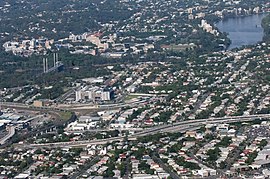 Aerial view of Dutton Park | |||||||||||||||
 Dutton Park | |||||||||||||||
| Coordinates | 27°29′39″S 153°01′33″E / 27.494167°S 153.025833°E / -27.494167; 153.025833Coordinates: 27°29′39″S 153°01′33″E / 27.494167°S 153.025833°E / -27.494167; 153.025833 | ||||||||||||||
| Population | 2,024 (2016 census)[1] | ||||||||||||||
| • Density | 2,248.92,250/km2 (5,8255,800/sq mi) | ||||||||||||||
| Postcode(s) | 4102 | ||||||||||||||
| Area | 0.9 km2 (0.3 sq mi) | ||||||||||||||
| Location | 4 km (2 mi) from Brisbane | ||||||||||||||
| LGA(s) | City of Brisbane (The Gabba Ward)[2] | ||||||||||||||
| State electorate(s) | South Brisbane | ||||||||||||||
| Federal Division(s) | Griffith | ||||||||||||||
| |||||||||||||||
Dutton Park is a suburb of Brisbane, Australia located about 4 kilometres (2.5 mi) south of the Brisbane CBD. The suburb is predominantly residential, with some light industrial and commercial areas.
Contents
1 History
1.1 Heritage listings
2 Geography
3 Attractions
4 Demographics
5 Transport
6 Institutions
7 References
8 External links
History

Charles Boydell Dutton, 1883
Development in the suburb was slow because of difficult terrain, and the fact that a large part of the area was surveyed for government reserves by H.C. Rawnsley in 1863.[3]
The name Dutton comes from Charles Boydell Dutton, the Queensland Minister for Lands from 1883 to 1887, who created the recreation reserve in 1884. This became known as 'Dutton's Park', a name which was later applied to surrounding estates, a school (originally known as the "Jail School")[4] and a railway station before becoming the name of the suburb.[5]
In 1884, the South Coast railway line was built, which included a station at Dutton Park. In 1886, the Dutton Park State School was opened.[6]
On 2 July 1883 the Boggo Road Gaol opened, firstly serving as a holding place for prisoners who were to be transported to St Helena Island but by 1989 housed over 300 prisoners. In 1903 a separate structure was opened adjacent to the main prison to house the female prisoners. After a Queensland Government inquiry into the living conditions of the inmates the female section of the prison was closed in 1989 with the male section closing in 1992 and later being demolished in 1996.

Shop of Janet Martin (née Gray) – Grandmother Martin – on the corner of Annerley Road and Tillot Street (ca. 1900)
Between 1901 and 1969 the suburb was served by electric trams. Tram services operated along Gladstone Road [7] and Annerley Road, with a connecting line to the Ipswich Road tram depot along Cornwall Street. J.S. Badger, owner of the Brisbane Tramway Company, developed the Dutton Park recreation reserve in order to increase patronage on the trams. For several years from 1908, open-air movie and variety shows known as 'Continentals' were held at the park, and proved enormously popular, drawing up to 5,000 people a night.[8]
Between 1912 and 1927 a tram depot was located in Lang Street (now Tamar Street).
Heritage listings
Dutton Park has a number of heritage-listed sites, including:
Boggo Road Gaol: No 2 Division and Remnant No 1 Division (150 Annerley Road)[9]
Gair Park (181 Annerley Road)[10]
South Brisbane Cemetery (21 Fairfield Road)[11]
Kurrowah (218 Gladstone Road)[12]
Geography

Pedestrian entrance of the Eleanor Schonell Bridge
Dutton Park lies on a ridge to the east of the Brisbane River, opposite from St Lucia. The site slopes down from Gladstone Road with an average gradient of 0.026.
Attractions

South Brisbane cemetery
The suburb is dominated by Dutton Park, which includes a large recreation area and public cemetery (colloquially known as Dutton Park Cemetery but officially known as South Brisbane Cemetery). The cemetery was reserved in 1866 and is Brisbane's oldest surviving municipal cemetery.[13] T. J. Doyle Memorial Drive passes through the park and along past the river; it was named after Thomas Joseph Doyle, alderman for South Brisbane ward of the City of Brisbane from 1954 to 1964.[14]
The former Boggo Road Gaol was located in the suburb and the remaining structure is now a historical museum.
On 17 December 2006, the Eleanor Schonell Bridge was opened, linking the St Lucia campus of the University of Queensland with southern Brisbane. The area is a popular place for picnics and tranquil riverside walks along the banks of the Brisbane River.
Demographics
In the 2016 census, Dutton Park had a population of 2,024 people. The median age of the Dutton Park population was 32 years, six years below the Australian median. Children aged under 15 years made up 14.4% of the population and people aged 65 years and over made up 12.1% of the population. 58.4% of people were born in Australia. 62.2% of people spoke only English at home. Other languages spoken at home included Greek at 5.1%. The most common responses for religion were No Religion 40.4% and Catholic 17.9%.[1]
Transport
By Bus, Brisbane Transport bus routes 192, 196 and 198 serve the suburb along Gladstone Road. Annerley Road to the City (via the Busway) is served by routes 105, 107, 108, 109, 116 and 202. With the opening of Dutton Park Place busway station on the Eleanor Schonell Bridge and the Boggo Road Busway, which opened on 3 August 2009, the suburb has become a major hub for the Brisbane City Busway as well as the terminating point for the Boggo Road Busway.
By Train, Dutton Park is served by the Dutton Park Railway Station which lies on the Beenleigh/Ferny Grove Line.
Institutions
The Ecosciences Precinct, part of the Boggo Road Urban Village development, was opened in 2011.[15] The precinct is a research facility for the Queensland Government, CSIRO and the University of Queensland through the Queensland Alliance for Agriculture and Food Innovation (QAAFI).[16]
References
^ ab Australian Bureau of Statistics (27 June 2017). "Dutton Park (State Suburb)". 2016 Census QuickStats. Retrieved 13 April 2018..mw-parser-output cite.citation{font-style:inherit}.mw-parser-output .citation q{quotes:"""""""'""'"}.mw-parser-output .citation .cs1-lock-free a{background:url("//upload.wikimedia.org/wikipedia/commons/thumb/6/65/Lock-green.svg/9px-Lock-green.svg.png")no-repeat;background-position:right .1em center}.mw-parser-output .citation .cs1-lock-limited a,.mw-parser-output .citation .cs1-lock-registration a{background:url("//upload.wikimedia.org/wikipedia/commons/thumb/d/d6/Lock-gray-alt-2.svg/9px-Lock-gray-alt-2.svg.png")no-repeat;background-position:right .1em center}.mw-parser-output .citation .cs1-lock-subscription a{background:url("//upload.wikimedia.org/wikipedia/commons/thumb/a/aa/Lock-red-alt-2.svg/9px-Lock-red-alt-2.svg.png")no-repeat;background-position:right .1em center}.mw-parser-output .cs1-subscription,.mw-parser-output .cs1-registration{color:#555}.mw-parser-output .cs1-subscription span,.mw-parser-output .cs1-registration span{border-bottom:1px dotted;cursor:help}.mw-parser-output .cs1-ws-icon a{background:url("//upload.wikimedia.org/wikipedia/commons/thumb/4/4c/Wikisource-logo.svg/12px-Wikisource-logo.svg.png")no-repeat;background-position:right .1em center}.mw-parser-output code.cs1-code{color:inherit;background:inherit;border:inherit;padding:inherit}.mw-parser-output .cs1-hidden-error{display:none;font-size:100%}.mw-parser-output .cs1-visible-error{font-size:100%}.mw-parser-output .cs1-maint{display:none;color:#33aa33;margin-left:0.3em}.mw-parser-output .cs1-subscription,.mw-parser-output .cs1-registration,.mw-parser-output .cs1-format{font-size:95%}.mw-parser-output .cs1-kern-left,.mw-parser-output .cs1-kern-wl-left{padding-left:0.2em}.mw-parser-output .cs1-kern-right,.mw-parser-output .cs1-kern-wl-right{padding-right:0.2em}

^ "The Gabba Ward". Brisbane City Council. Brisbane City Council. Retrieved 19 March 2017.
^ Christopher Dawson, Brisbane Beginnings: Dutton Park, Brisbane, Inside History, 2009, p.10.
^ Annerley District: Growth of a Valuable Suburb, Brisbane Courier, Saturday 10 January 1931, page 19
^ Christopher Dawson, Absolute Fairyland: Heady days in Dutton Park, Brisbane, Inside History, 2006, pp.1-8.
^ DPSS, Dutton Park State School 2009 to 1884: A journey, Brisbane, DPSS, 2009.
^ Brisbane tramway museum
^ Dawson, Absolute Fairyland, pp.8-22.
^ "Boggo Road Gaol: No 2 Division and Remnant No 1 Division (entry 601033)". Queensland Heritage Register. Queensland Heritage Council. Retrieved 19 June 2013.
^ "Gair Park (entry 602429)". Queensland Heritage Register. Queensland Heritage Council. Retrieved 19 June 2013.
^ "South Brisbane Cemetery (entry 602406)". Queensland Heritage Register. Queensland Heritage Council. Retrieved 19 June 2013.
^ "Kurrowah (entry 602827)". Queensland Heritage Register. Queensland Heritage Council. Retrieved 1 August 2014.
^ Tracey Olivieri, In the Beginning: The early years of South Brisbane Cemetery, Inside History, Brisbane, 2008.
^ "One candidate". The Courier-Mail. Brisbane: National Library of Australia. 2 August 1954. p. 3. Retrieved 20 July 2014.
^ "Ecosciences Precinct opens at Boggo Road". Ministerial Media Statement, April 2011. Department of the Premier and Cabinet, Queensland Government. Retrieved 21 June 2012.
^ "Ecosciences Precinct". Science in Queensland. Queensland Government. Retrieved 21 June 2012.
External links
| Wikimedia Commons has media related to Dutton Park, Queensland. |
- Friends of South Brisbane Cemetery
- Boggo Road Gaol Historical Society
- University of Queensland: Queensland Places: Dutton Park
- Dutton Park Resource


