Qartaba
Qartaba قرطبا | |
|---|---|
City | |
 Qartaba At Night | |
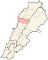
 Qartaba Location within Lebanon | |
| Coordinates: 34°06′N 35°51′E / 34.100°N 35.850°E / 34.100; 35.850Coordinates: 34°06′N 35°51′E / 34.100°N 35.850°E / 34.100; 35.850 | |
| Country | |
| Governorate | Mount Lebanon Governorate |
| District | Jbeil District |
| Time zone | UTC+2 (EET) |
| • Summer (DST) | UTC+3 (EEST) |
| Dialing code | +961 |
Qartaba (Arabic: قرطبا, also spelled kartaba) is a village in the Jbeil District of the Mount Lebanon Governorate, Lebanon. It is located 54 kilometers north Beirut on the mountains above Byblos at an altitude of 1,250 meters.[1] The town has large church square, and is surrounded by olive groves, mulberry orchards, and vineyards.[2] In Syriac, Qartaba means "good, curing and balanced weather".
Contents
1 History
2 Demographics
3 Gallery
4 References
5 External links
History
Qartaba was once considered an important village in the Jbeil highland, a trade point for surrounding villages.[1] Silk manufacturing flourished and in 1918, seven factories employed more than 500 people and much of the silk was exported to Lyon, France.[1]
Demographics
The inhabitants of Qartaba are predominantly Maronite Catholics.[3] The families of the village include Sakr ,Challita, Saad, El-Sokhn, Karam, Beyrouthy (El Kassis), El-Khoury, Acar, Gharios, Cherfane and Salem.[citation needed]
Gallery


References
^ abc "Kartaba". Linking Lebanon. Retrieved 2007-12-08..mw-parser-output cite.citation{font-style:inherit}.mw-parser-output .citation q{quotes:"""""""'""'"}.mw-parser-output .citation .cs1-lock-free a{background:url("//upload.wikimedia.org/wikipedia/commons/thumb/6/65/Lock-green.svg/9px-Lock-green.svg.png")no-repeat;background-position:right .1em center}.mw-parser-output .citation .cs1-lock-limited a,.mw-parser-output .citation .cs1-lock-registration a{background:url("//upload.wikimedia.org/wikipedia/commons/thumb/d/d6/Lock-gray-alt-2.svg/9px-Lock-gray-alt-2.svg.png")no-repeat;background-position:right .1em center}.mw-parser-output .citation .cs1-lock-subscription a{background:url("//upload.wikimedia.org/wikipedia/commons/thumb/a/aa/Lock-red-alt-2.svg/9px-Lock-red-alt-2.svg.png")no-repeat;background-position:right .1em center}.mw-parser-output .cs1-subscription,.mw-parser-output .cs1-registration{color:#555}.mw-parser-output .cs1-subscription span,.mw-parser-output .cs1-registration span{border-bottom:1px dotted;cursor:help}.mw-parser-output .cs1-ws-icon a{background:url("//upload.wikimedia.org/wikipedia/commons/thumb/4/4c/Wikisource-logo.svg/12px-Wikisource-logo.svg.png")no-repeat;background-position:right .1em center}.mw-parser-output code.cs1-code{color:inherit;background:inherit;border:inherit;padding:inherit}.mw-parser-output .cs1-hidden-error{display:none;font-size:100%}.mw-parser-output .cs1-visible-error{font-size:100%}.mw-parser-output .cs1-maint{display:none;color:#33aa33;margin-left:0.3em}.mw-parser-output .cs1-subscription,.mw-parser-output .cs1-registration,.mw-parser-output .cs1-format{font-size:95%}.mw-parser-output .cs1-kern-left,.mw-parser-output .cs1-kern-wl-left{padding-left:0.2em}.mw-parser-output .cs1-kern-right,.mw-parser-output .cs1-kern-wl-right{padding-right:0.2em}
^ Ivan Mannheim (2001). Syria & Lebanon Handbook: The Travel Guide. Footprint Travel Guides. p. 502. ISBN 1-900949-90-3.
^ "Elections municipales et ikhtiariah au Mont-Liban" (PDF). Localiban. Localiban. 2010. p. 19. Archived from the original (pdf) on 2015-07-24. Retrieved 2016-02-12.
External links
- Kartaba - Byblos' Bride
Capital: Jbeil | ||
| Towns and villages |
|  |
| Landmarks |
| |
This Lebanon location article is a stub. You can help Wikipedia by expanding it. |


