Tongliao
Tongliao .mw-parser-output .nobold{font-weight:normal} 通辽市 • .mw-parser-output .font-mong{font-family:"Menk Hawang Tig","Menk Qagan Tig","Menk Garqag Tig","Menk Har_a Tig","Menk Scnin Tig","Oyun Gurban Ulus Tig","Oyun Qagan Tig","Oyun Garqag Tig","Oyun Har_a Tig","Oyun Scnin Tig","Oyun Agula Tig","Mongolian BT","Mongolian Baiti","Noto Sans Mongolian","Mongol Usug","Mongolian White","MongolianScript","Code2000","Menksoft Qagan"}.mw-parser-output .font-mong-mnc,.mw-parser-output .font-mong:lang(mnc-Mong),.mw-parser-output .font-mong:lang(dta-Mong),.mw-parser-output .font-mong:lang(sjo-Mong){font-family:"Abkai Xanyan","Abkai Xanyan LA","Abkai Xanyan VT","Abkai Xanyan XX","Abkai Xanyan SC","Abkai Buleku","Daicing White","Oyun Gurban Ulus Tig","Oyun Qagan Tig","Oyun Garqag Tig","Oyun Har_a Tig","Oyun Scnin Tig","Oyun Agula Tig","Mongolian BT","Mongolian Baiti","Noto Sans Mongolian"} ᠲᠦᠩᠯᠢᠶᠣᠤ ᠬᠣᠲᠠ | |
|---|---|
Prefecture-level city | |
 | |
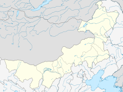
 Location of Tongliao City jurisdiction in Inner Mongolia | |
 Tongliao Location of the city centre in Inner Mongolia | |
| Coordinates: 43°37′N 122°16′E / 43.617°N 122.267°E / 43.617; 122.267Coordinates: 43°37′N 122°16′E / 43.617°N 122.267°E / 43.617; 122.267 | |
| Country | People's Republic of China |
| Region | Inner Mongolia |
| Area | |
| • Urban (2018)[1] | 168 km2 (65 sq mi) |
| Elevation | 179 m (587 ft) |
| Population (2010) | |
| • Prefecture-level city | 3,139,153 |
| • Urban (2018)[2] | 940,000 |
| • Urban density | 5,600/km2 (14,000/sq mi) |
| Time zone | UTC+8 (China Standard) |
| ISO 3166 code | CN-NM-05 |
| Website | tongliao.gov.cn |
| Tongliao | |||||||
| Chinese name | |||||||
|---|---|---|---|---|---|---|---|
| Simplified Chinese | 通辽 | ||||||
| Traditional Chinese | 通遼 | ||||||
| |||||||
| Mongolian name | |||||||
| Mongolian Cyrillic | Тонляо хот | ||||||
| Mongolian script | ᠲᠦᠩᠯᠢᠶᠣᠤ ᠬᠣᠲᠠ | ||||||
| |||||||
Tongliao (Mongolian:
ᠲᠦᠩᠯᠢᠶᠣᠤ ᠬᠣᠲᠠ Tüŋliyou qota, Тонляо хот; Chinese: 通辽市) is a prefecture-level city in eastern Inner Mongolia, People's Republic of China. The area is 59,535 square kilometres (22,987 sq mi) and population is 3,139,153 (as of 2010); the city proper has 898,895 inhabitants (2010).[3] The city was the administrative centre of the defunct Jirem League (哲里木盟;
ᠵᠢᠷᠢᠮ ᠠᠶᠢᠮᠠᠭ Jirim ayimaɣ).
The original Mongolian name for Tongliao city proper (i.e. Horqin District) is Bayisingtu (Chinese: 白音泰赉; pinyin: Báiyīntàilài; literally: "having buildings"), while the original name of the prefecture-level city is Jirem. The Mongolian dialect spoken in this area is Khorchin Mongolian.
Contents
1 History
2 Geography and climate
3 Subdivisions
4 Demographics
5 Transport
6 Education
7 References
8 External links
History
Human settlement in Tongliao and surrounding Khorchin area dates from at least 1000 BC. The Donghu people, a tribe who spoke a proto-Mongolian language, settled in today's Tongliao area, north of Yan during Warring States period[4]. their culture was associated with the Upper Xiajiadian culture, characterized by the practice of agriculture and animal husbandry supplemented by handicrafts and bronze art.[5] Later, the Tongliao area was controlled by Xiongnu, Xianbei, and Khitan tribes.
After the Mongolian Khanate had established the Yuan Dynasty in Chinese territory, Tongliao was put under the jurisdiction of Liaoyang province, whose provincial capital was in today's Liaoning Province. In the early Qing period, Khorchin, Dörbod, Jalaid and Gorlos tribes met in Jirem to establish an alliance, and the Jirem League was founded in 1636 to administer Khorchin territory. The Jirem League had jurisdiction over six Khorchin banners, two Gorlos banners, one Dorbod banner and one Jalaid banner. During the Republican period, the Jirem League and the surrounding Khorchin area was controlled by the Fengtian and Liaoning provinces.
In 1918, Tongliao County was first established under the administration of the Jirem League and Fengtian province. After the Japanese Kwantung Army invaded Manchuria in 1931, a Japanese-controlled puppet state Manchukuo was established in Hsinking, 280 kilometers away from today's Tongliao urban area. The Manchukuo government set up Xing'an Province and soon divided it into four parts, in order to govern the western part of former Heilongjiang, Jilin and Fengtian provinces. These Xing'an provinces roughly overlap today's eastern part of Inner Mongolia, including today's Hulunbuir League, Xingan League, Chifeng and Tongliao. After the dissolution of the Manchukuo state, the Jirem League was governed by Liaoning and Liaobei provinces until Ulanhu established Inner Mongolia in Ulanhot, governing eastern Mongolian areas including the Hulunbuir, Jirem and Ju'ud leagues. After 1969, the Jirem League was put under the administration of Jilin province administration for 10 years until 1979. In 1999, the Jirem League became defunct and changed its name to Tongliao city, which was set up a prefecture-level city.
Geography and climate
It borders Jilin province to the east, Liaoning to the south, Chifeng to the southwest, the Xilin Gol League to the west, and the Hinggan League to the north. Not far from Tongliao are silica sands. Tongliao has a total area of 59,535 square kilometres (22,987 sq mi), accounting for 5.4% of Inner Mongolia's total.[6]
Tongliao has a four-season, monsoon-influenced, continental steppe climate (Köppen BSk), with long, cold, windy, but dry winters, and hot, humid summers. Monthly mean temperatures range from −13.5 °C (7.7 °F) in January to 24.1 °C (75.4 °F) in July, with an annual mean of 6.63 °C (43.9 °F). Much of the year's rainfall occurs from June to August, and even then dry and sunny weather dominates in the city. With monthly percent possible sunshine ranging from 57% in July to 78% in January, sunshine is abundant year-round, with 3,054 hours of bright sunshine annually.
| Climate data for Tongliao (1971−2000) | |||||||||||||
|---|---|---|---|---|---|---|---|---|---|---|---|---|---|
| Month | Jan | Feb | Mar | Apr | May | Jun | Jul | Aug | Sep | Oct | Nov | Dec | Year |
| Average high °C (°F) | −6.8 (19.8) | −2.4 (27.7) | 5.6 (42.1) | 15.8 (60.4) | 22.9 (73.2) | 27.4 (81.3) | 29.3 (84.7) | 28.1 (82.6) | 22.9 (73.2) | 14.5 (58.1) | 3.6 (38.5) | −4.6 (23.7) | 13 (55.4) |
| Average low °C (°F) | −18.8 (−1.8) | −15.1 (4.8) | −7.1 (19.2) | 2.2 (36) | 9.6 (49.3) | 15.5 (59.9) | 19.2 (66.6) | 17.3 (63.1) | 10.0 (50) | 1.7 (35.1) | −7.9 (17.8) | −15.8 (3.6) | 0.90 (33.62) |
| Average precipitation mm (inches) | 1.5 (0.06) | 2.1 (0.08) | 7.1 (0.28) | 14.2 (0.56) | 34.1 (1.34) | 74.0 (2.91) | 103.9 (4.09) | 79.3 (3.12) | 30.5 (1.2) | 19.0 (0.75) | 4.9 (0.19) | 2.8 (0.11) | 373.4 (14.69) |
| Average precipitation days (≥ 0.1 mm) | 1.6 | 2.3 | 3.4 | 4.6 | 7.4 | 11.0 | 11.6 | 9.4 | 7.2 | 4.3 | 2.6 | 2.4 | 67.8 |
| Average relative humidity (%) | 54 | 47 | 43 | 41 | 46 | 62 | 73 | 73 | 63 | 55 | 54 | 55 | 56 |
| Mean monthly sunshine hours | 224.7 | 225.3 | 272.7 | 272.0 | 293.1 | 284.2 | 267.2 | 272.8 | 268.1 | 251.3 | 216.2 | 206.0 | 3,053.6 |
| Percent possible sunshine | 78 | 77 | 74 | 68 | 65 | 62 | 57 | 63 | 72 | 74 | 74 | 74 | 69 |
| Source: China Meteorological Administration | |||||||||||||
Subdivisions
| Map | |||||||
|---|---|---|---|---|---|---|---|
 | |||||||
| # | Name | Mongolian | Hanzi | Hanyu Pinyin | Population (2010) | Area (km²) | Density (/km²) |
| 1 | Horqin District | ᠬᠣᠷᠴᠢᠨ ᠲᠣᠭᠣᠷᠢᠭ (Qorčin toɣoriɣ) | 科尔沁区 | Kē'ěrqìn Qū | 898,895 | 3,212 | 252 |
| 2 | Holingol City | ᠬᠣᠣᠯᠢᠨ ᠭᠣᠣᠯ ᠬᠣᠲᠠ (Qoolin Ɣool qota) | 霍林郭勒市 | Huòlínguōlè Shì | 102,214 | 585 | 120 |
| 3 | Kailu County | ᠺᠠᠶᠢᠯᠦ ᠰᠢᠶᠠᠨ (Ḵayilü siyan) | 开鲁县 | Kāilǔ Xiàn | 396,166 | 4,488 | 87 |
| 4 | Hure Banner | ᠬᠦᠷᠢᠶᠡ ᠬᠣᠰᠢᠭᠤ (Küriy-e qosiɣu) | 库伦旗 | Kùlún Qí | 167,020 | 4,650 | 39 |
| 5 | Naiman Banner | ᠨᠠᠢᠮᠠᠨ ᠬᠣᠰᠢᠭᠤ (Naiman qosiɣu) | 奈曼旗 | Nàimàn Qí | 401,509 | 8,120 | 53 |
| 6 | Jarud Banner | ᠵᠠᠷᠤᠳ ᠬᠣᠰᠢᠭᠤ (Jarud qosiɣu) | 扎鲁特旗 | Zālǔtè Qí | 279,371 | 17,193 | 17 |
| 7 | Horqin Left Middle Banner (Horqin Jun Garun Dundad Banner) | ᠬᠣᠷᠴᠢᠨ ᠵᠡᠭᠦᠨ ᠭᠠᠷᠤᠨ ᠳᠤᠮᠳᠠᠳᠤ ᠬᠣᠰᠢᠭᠤ (Qorčin Jegün Ɣarun Dumdadu qosiɣu) | 科尔沁左翼中旗 | Kē'ěrqìn Zuǒyì Zhōng Qí | 514,741 | 9,811 | 54 |
| 8 | Horqin Left Back Banner (Horqin Jun Garun Hoit Banner) | ᠬᠣᠷᠴᠢᠨ ᠵᠡᠭᠦᠨ ᠭᠠᠷᠤᠨ ᠬᠣᠶᠢᠲᠤ ᠬᠣᠰᠢᠭᠤ (Qorčin Jegün Ɣarun Qoyitu qosiɣu) | 科尔沁左翼后旗 | Kē'ěrqìn Zuǒyì Hòu Qí | 379,237 | 11,476 | 35 |
Demographics
Ethnic groups in Tongliao, 2000 census.
| Ethnicity | Population | Percentage |
|---|---|---|
Han Chinese | 1.548.721 | 51,14% |
Mongol | 1.373.470 | 45,35% |
Manchu | 88.654 | 2,93% |
Hui Chinese | 12.447 | 0,41% |
Korean | 2.709 | 0,09% |
Xibe | 781 | 0,03% |
Daur | 492 | 0,02% |
Transport
Tongliao is a railway hub in both Inner Mongolia and Northeast China. Tongliao-Beijing Railway conveniently connects the city with Beijing. There are also rails connect Tongliao with Shenyang, Daqing and Jining. State Highway 111, State Highway 303, State Highway 304 and State Highway 204 run through the city and extend to harbor cities such as Tianjin, Dalian, and Qinhuangdao.
Education
Inner Mongolia University for Nationalities and Inner Mongolia College of Farming and Animal Husbandry are among the educational institutions of Tongliao.
References
^ Cox, W (2018). Demographia World Urban Areas. 14th Annual Edition (PDF). St. Louis: Demographia. p. 22..mw-parser-output cite.citation{font-style:inherit}.mw-parser-output q{quotes:"""""""'""'"}.mw-parser-output code.cs1-code{color:inherit;background:inherit;border:inherit;padding:inherit}.mw-parser-output .cs1-lock-free a{background:url("//upload.wikimedia.org/wikipedia/commons/thumb/6/65/Lock-green.svg/9px-Lock-green.svg.png")no-repeat;background-position:right .1em center}.mw-parser-output .cs1-lock-limited a,.mw-parser-output .cs1-lock-registration a{background:url("//upload.wikimedia.org/wikipedia/commons/thumb/d/d6/Lock-gray-alt-2.svg/9px-Lock-gray-alt-2.svg.png")no-repeat;background-position:right .1em center}.mw-parser-output .cs1-lock-subscription a{background:url("//upload.wikimedia.org/wikipedia/commons/thumb/a/aa/Lock-red-alt-2.svg/9px-Lock-red-alt-2.svg.png")no-repeat;background-position:right .1em center}.mw-parser-output .cs1-subscription,.mw-parser-output .cs1-registration{color:#555}.mw-parser-output .cs1-subscription span,.mw-parser-output .cs1-registration span{border-bottom:1px dotted;cursor:help}.mw-parser-output .cs1-hidden-error{display:none;font-size:100%}.mw-parser-output .cs1-visible-error{font-size:100%}.mw-parser-output .cs1-subscription,.mw-parser-output .cs1-registration,.mw-parser-output .cs1-format{font-size:95%}.mw-parser-output .cs1-kern-left,.mw-parser-output .cs1-kern-wl-left{padding-left:0.2em}.mw-parser-output .cs1-kern-right,.mw-parser-output .cs1-kern-wl-right{padding-right:0.2em}
^ Cox, W (2018). Demographia World Urban Areas. 14th Annual Edition (PDF). St. Louis: Demographia. p. 22.
^ (in Chinese)Data from the Sixth National Population Census of the People's Republic of China Archived 2014-01-13 at the Wayback Machine.
^ Watson (1993), p. 132.
^ Lin (2007)[page needed]
^ Profiles of China Provinces, Cities and Industrial Parks
External links
- Tungliyo Government (in Mongolian)
- Tongliao Government (in Chinese)
www.tongliao.info (in Chinese)
Inner Mongolia topics | |
|---|---|
Hohhot (capital) | |
| General |
|
| Geography |
|
| Education |
|
| Culture |
|
| Cuisine |
|
| Visitor attractions |
|
| |


