European route E16
Coordinates: 54°59′38″N 7°19′34″W / 54.994°N 7.326°W / 54.994; -7.326
E16 | |
|---|---|
| Route information | |
| Length | 1,180 km (730 mi) |
| Major junctions | |
| West end | Derry, United Kingdom |
| East end | Gävle, Sweden |
| Location | |
| Countries | |
| Highway system | |
| International E-road network | |

European route E 16 is the designation of a main west-east road through Northern Ireland, Scotland, Norway and Sweden, from Derry to Gävle, via Belfast, Glasgow, Edinburgh, previously by ferry to Bergen, Voss, through the Gudvanga Tunnel and the Lærdal Tunnel (the world's longest road tunnel), Lærdal, over Filefjell to Fagernes, Hønefoss, Gardermoen and Kongsvinger. In Sweden it passes Malung, Falun and ends in Gävle.[1]
Contents
1 United Kingdom
2 Norway
3 Sweden
4 History
5 Gallery
6 References
United Kingdom
Northern Ireland
 : Derry -
: - Antrim
 : Antrim - Belfast (Multiplex with
  and
and  between
  and Belfast)
Great Britain
 : Glasgow (Interchange with
  at
at  ) - Edinburgh (Interchange with
  at
at  )
)
In Northern Ireland, it follows the A6 from Derry to Randalstown, then the M22 and M2 to Belfast. In Scotland it follows the M8 from Glasgow to Edinburgh.
E16 meets the E01 and E18 in Belfast, the E5 in Glasgow, the E15 in Edinburgh. European routes are not signposted in the UK. There is no ferry anymore between the United Kingdom and Norway.
Norway
The E16 is the main road between Norway's two largest cities Oslo and Bergen, and the only mountain pass between Oslo and Bergen that is rarely closed due to snowstorms and blizzards (it goes below the tree line). Outside winter, route 7 is at least as popular between Oslo and Bergen, since it is shorter. There are some other options such as the road through Hemsedal. The E16 is narrow on many places in Norway, although upgrades are being built.
E16 is 630 kilometres (390 mi) long in Norway. E16 meets the European route E39 in Bergen and the European route E6 at Gardermoen.
Sweden
E16 is 360 kilometres (220 mi) long in Sweden. E16 connected to the European route E45 between Torsby and Malung, and European route E4 in Gävle. There is no customs control at the Norway-Sweden border (but there is video surveillance), meaning that transports needing to be declared for customs, including most lorries, are not allowed to use the E16 at the border.
History
The road number E16 was introduced in Norway in 1992, between Bergen and Oslo. The road Bergen–Oslo was called E68 in the old E-road system decided 1950.[2] In 1975, a new system was decided, where E16 only went through the United Kingdom (Londonderry–Edinburgh), and Bergen–Oslo was called E136.[3] This was changed after several revisions of the agreement.
In 2011 it was decided to extend E16 from the Oslo region eastwards through Kongsvinger, Torsby, Malung, Borlänge to Gävle in Sweden.[4][5] The signposting took place autumn 2012.
A large road construction project was finished 1992 when a new routing was opened almost all the way between Bergen and Voss. A further large project were the tunnels between Gudvangen and Lærdal which total around 43 km, finished 2000.
Gallery
| Wikimedia Commons has media related to E16. |
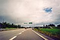
Road E 16 west of Gävle
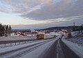
Road E 16 near Falun in Sweden
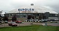
Kupolen shopping centre in Borlänge
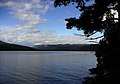
Scenic view over lake Sperillen

The mediaeval stone church Slidredomen

The Kvamskleiv tunnel and the Vangsmjøse lake in the mountains

The Lærdal Tunnel is the longest road tunnel in the world, 24.5 km (15.2 mi).

In the Aurland valley

View over the Aurlandsfjord with Flåm innermost in the fiord

Nærøyfjord is on the list of World Heritage Sites
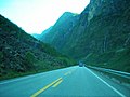
Road E 16 near Gudvangen in Norway

Bryggen in Bergen, Norway
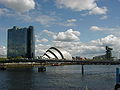
Clyde in Glasgow

The old castle in Edinburgh

River Foyle in Derry


References
^ UN ECE European Agreement on Main International Traffic Arteries (AGR)
^ Declaration on the construction of main international traffic arteries. 1950 - 1961
^ "volume-1302-l-21618-English.pdf" (pdf). Retrieved 2017-06-08..mw-parser-output cite.citation{font-style:inherit}.mw-parser-output q{quotes:"""""""'""'"}.mw-parser-output code.cs1-code{color:inherit;background:inherit;border:inherit;padding:inherit}.mw-parser-output .cs1-lock-free a{background:url("//upload.wikimedia.org/wikipedia/commons/thumb/6/65/Lock-green.svg/9px-Lock-green.svg.png")no-repeat;background-position:right .1em center}.mw-parser-output .cs1-lock-limited a,.mw-parser-output .cs1-lock-registration a{background:url("//upload.wikimedia.org/wikipedia/commons/thumb/d/d6/Lock-gray-alt-2.svg/9px-Lock-gray-alt-2.svg.png")no-repeat;background-position:right .1em center}.mw-parser-output .cs1-lock-subscription a{background:url("//upload.wikimedia.org/wikipedia/commons/thumb/a/aa/Lock-red-alt-2.svg/9px-Lock-red-alt-2.svg.png")no-repeat;background-position:right .1em center}.mw-parser-output .cs1-subscription,.mw-parser-output .cs1-registration{color:#555}.mw-parser-output .cs1-subscription span,.mw-parser-output .cs1-registration span{border-bottom:1px dotted;cursor:help}.mw-parser-output .cs1-hidden-error{display:none;font-size:100%}.mw-parser-output .cs1-visible-error{font-size:100%}.mw-parser-output .cs1-subscription,.mw-parser-output .cs1-registration,.mw-parser-output .cs1-format{font-size:95%}.mw-parser-output .cs1-kern-left,.mw-parser-output .cs1-kern-wl-left{padding-left:0.2em}.mw-parser-output .cs1-kern-right,.mw-parser-output .cs1-kern-wl-right{padding-right:0.2em}
^ 60°40′30″N 17°08′31″E / 60.675°N 17.142°E / 60.675; 17.142
^ "Archived copy" (PDF). Archived from the original (PDF) on 17 March 2012. Retrieved 20 January 2011.CS1 maint: Archived copy as title (link)
International E-road network | ||
|---|---|---|
|  | |
| ||


