Hardin County, Texas
Hardin County, Texas | |
|---|---|
 The Hardin County Courthouse in Kountze | |
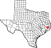
 Location in the U.S. state of Texas | |
 Texas's location in the U.S. | |
| Founded | 1858 |
| Seat | Kountze |
| Largest city | Lumberton |
| Area | |
| • Total | 898 sq mi (2,326 km2) |
| • Land | 891 sq mi (2,308 km2) |
| • Water | 7.0 sq mi (18 km2), 0.8% |
| Population | |
| • (2010) | 54,635 |
| • Density | 61/sq mi (24/km2) |
| Congressional district | 36th |
| Time zone | Central: UTC−6/−5 |
| Website | www.co.hardin.tx.us |
Hardin County is a county located in the U.S. state of Texas, United States. As of the 2010 census, its population was 54,635.[1] The county seat is Kountze.[2] The county is named for the family of William Hardin from Liberty County, Texas.[3]
Hardin County is part of the Beaumont-Port Arthur, TX Metropolitan Statistical Area.
Contents
1 History
2 Geography
2.1 Major highways
2.2 Adjacent counties
2.3 National protected area
3 Demographics
4 Communities
4.1 Cities
4.2 Census-designated places
4.3 Unincorporated communities
4.4 Ghost Towns
5 Politics
5.1 United States Congress
6 See also
7 References
8 External links
History
The current Hardin County Courthouse was built in 1959. It is at least the third courthouse to serve Hardin County.[4]
Geography
According to the U.S. Census Bureau, the county has a total area of 898 square miles (2,330 km2), of which 891 square miles (2,310 km2) are land and 7.0 square miles (18 km2) (0.8%) are covered by water.[5]
Hardin County is located on the flat coastal plains of Southeast Texas, roughly 30 mi (48 km) north of the Gulf of Mexico. The county is largely covered by the dense forest of the Big Thicket. It is crossed by numerous small streams and creeks which drain the county into the Neches River, which forms the eastern boundary of the county.
Major highways

 U.S. Highway 69/U.S. Highway 287
 U.S. Highway 96
 State Highway 105
 State Highway 326
 State Highway 327

 U.S. Highway 69/U.S. Highway 287
 U.S. Highway 96
 State Highway 105
 State Highway 326
 State Highway 327
Adjacent counties
Tyler County (northern)
Jasper County (east)
Orange County (southeast)
Jefferson County (south)
Liberty County (southwest)
Polk County (northwest)
Its eastern boundaries with Jasper County and Orange County are formed by the Neches River. The southern boundary with Jefferson County is formed by Pine Island Bayou
National protected area
Big Thicket National Preserve (part)
Demographics
| Historical population | |||
|---|---|---|---|
| Census | Pop. | %± | |
| 1860 | 1,353 | — | |
| 1870 | 1,460 | 7.9% | |
| 1880 | 1,870 | 28.1% | |
| 1890 | 3,956 | 111.6% | |
| 1900 | 5,049 | 27.6% | |
| 1910 | 12,947 | 156.4% | |
| 1920 | 15,983 | 23.4% | |
| 1930 | 13,936 | −12.8% | |
| 1940 | 15,875 | 13.9% | |
| 1950 | 19,535 | 23.1% | |
| 1960 | 24,629 | 26.1% | |
| 1970 | 29,996 | 21.8% | |
| 1980 | 40,721 | 35.8% | |
| 1990 | 41,320 | 1.5% | |
| 2000 | 48,073 | 16.3% | |
| 2010 | 54,635 | 13.7% | |
| Est. 2016 | 56,322 | [6] | 3.1% |
| U.S. Decennial Census[7] 1850–2010[8] 2010–2014[1] | |||
As of the 2010 census, Hardin County had a population of 54,635. The ethnic and racial composition of the population was 88.0% non-Hispanic white, 5.8% African American, 0.4% Native American, 0.5% Asian, 1.3% from some other race, and 1.3% from two or more races.[9]
As of the census[10] of 2000, 48,073 people, 17,805 households, and 13,638 families resided in the county. The population density was 54 people per square mile (21/km²). The 19,836 housing units averaged 22 per square mile (9/km²). The racial makeup of the county was 90.86% White, 6.91% Black or African American, 0.32% Native American, 0.23% Asian, 0.01% Pacific Islander, 0.74% from other races, and 0.93% from two or more races. About 2.54% of the population were Hispanic or Latino of any race.
Of the 17,805 households, 37.2% had children under the age of 18 living with them, 62.6% were married couples living together, 10.2% had a female householder with no husband present, and 23.4% were not families; 20.7% of all households were made up of individuals, and 9.2% had someone living alone who was 65 years of age or older. The average household size was 2.68 and the average family size was 3.09.
In the county, the population was distributed as 27.8% under the age of 18, 8.5% from 18 to 24, 28.3% from 25 to 44, 23.2% from 45 to 64, and 12.2% who were 65 years of age or older. The median age was 36 years. For every 100 females, there were 96.7 males. For every 100 females age 18 and over, there were 92.4 males.
The median income for a household in the county was $37,612, and for a family was $42,890. Males had a median income of $35,881 versus $22,823 for females. The per capita income for the county was $17,962. About 8.8% of families and 11.20% of the population were below the poverty line, including 13.3% of those under age 18 and 10.6% of those age 65 or over.
Communities
Cities
Kountze (county seat)- Lumberton
- Rose Hill Acres
- Silsbee
- Sour Lake
Census-designated places
- Pinewood Estates
Wildwood (partly in Tyler County)
Unincorporated communities
- Batson
- Honey Island
- Natton
- Saratoga
- Thicket
- Village Mills
- Votaw
Ghost Towns
- Bragg
Politics
United States Congress
Senators | Name | Party | First Elected | Level | |
|---|---|---|---|---|---|
| | Senate Class 1 | John Cornyn | Republican | 1993 | Senior Senator |
| | Senate Class 2 | Ted Cruz | Republican | 2012 | Junior Senator |
Representatives | Name | Party | First Elected | Area(s) of Hardin County Represented | |
| | District 36 | Brian Babin | Republican | New district created with 2010 census. First elected 2014. | Entire county |
| Year | Republican | Democratic | Third parties |
|---|---|---|---|
2016 | 86.1% 19,606 | 12.2% 2,780 | 1.7% 394 |
2012 | 83.3% 17,746 | 15.8% 3,359 | 0.9% 192 |
2008 | 80.2% 16,603 | 19.0% 3,939 | 0.8% 160 |
2004 | 72.6% 15,030 | 27.1% 5,608 | 0.4% 72 |
2000 | 67.1% 11,962 | 31.4% 5,595 | 1.6% 279 |
1996 | 47.7% 8,529 | 40.1% 7,179 | 12.3% 2,192 |
1992 | 35.0% 5,885 | 40.2% 6,753 | 24.7% 4,155 |
1988 | 45.5% 6,897 | 54.3% 8,245 | 0.2% 31 |
1984 | 55.1% 8,380 | 44.6% 6,782 | 0.3% 44 |
1980 | 44.3% 6,087 | 53.6% 7,358 | 2.1% 287 |
1976 | 37.9% 4,046 | 61.4% 6,558 | 0.8% 84 |
1972 | 63.6% 5,190 | 36.2% 2,952 | 0.2% 15 |
1968 | 22.4% 1,986 | 32.7% 2,894 | 44.9% 3,982 |
1964 | 27.8% 1,987 | 72.0% 5,143 | 0.2% 16 |
1960 | 32.8% 2,115 | 66.9% 4,315 | 0.3% 21 |
1956 | 47.1% 2,130 | 52.5% 2,371 | 0.4% 19 |
1952 | 32.5% 1,653 | 67.4% 3,423 | 0.1% 6 |
1948 | 6.4% 196 | 73.4% 2,233 | 20.2% 614 |
1944 | 7.8% 243 | 84.2% 2,632 | 8.0% 251 |
1940 | 7.0% 226 | 92.9% 2,997 | 0.1% 2 |
1936 | 4.8% 119 | 95.2% 2,351 | |
1932 | 5.5% 161 | 94.5% 2,783 | |
1928 | 48.0% 951 | 52.0% 1,032 | |
1924 | 28.3% 645 | 66.6% 1,516 | 5.1% 117 |
1920 | 14.7% 202 | 72.6% 999 | 12.7% 175 |
1916 | 10.3% 158 | 83.4% 1,279 | 6.3% 97 |
1912 | 7.2% 101 | 69.6% 979 | 23.2% 327 |
See also

- National Register of Historic Places listings in Hardin County, Texas
- Recorded Texas Historic Landmarks in Hardin County
References
^ ab "State & County QuickFacts". United States Census Bureau. Archived from the original on July 11, 2011. Retrieved December 17, 2013..mw-parser-output cite.citation{font-style:inherit}.mw-parser-output q{quotes:"""""""'""'"}.mw-parser-output code.cs1-code{color:inherit;background:inherit;border:inherit;padding:inherit}.mw-parser-output .cs1-lock-free a{background:url("//upload.wikimedia.org/wikipedia/commons/thumb/6/65/Lock-green.svg/9px-Lock-green.svg.png")no-repeat;background-position:right .1em center}.mw-parser-output .cs1-lock-limited a,.mw-parser-output .cs1-lock-registration a{background:url("//upload.wikimedia.org/wikipedia/commons/thumb/d/d6/Lock-gray-alt-2.svg/9px-Lock-gray-alt-2.svg.png")no-repeat;background-position:right .1em center}.mw-parser-output .cs1-lock-subscription a{background:url("//upload.wikimedia.org/wikipedia/commons/thumb/a/aa/Lock-red-alt-2.svg/9px-Lock-red-alt-2.svg.png")no-repeat;background-position:right .1em center}.mw-parser-output .cs1-subscription,.mw-parser-output .cs1-registration{color:#555}.mw-parser-output .cs1-subscription span,.mw-parser-output .cs1-registration span{border-bottom:1px dotted;cursor:help}.mw-parser-output .cs1-hidden-error{display:none;font-size:100%}.mw-parser-output .cs1-visible-error{font-size:100%}.mw-parser-output .cs1-subscription,.mw-parser-output .cs1-registration,.mw-parser-output .cs1-format{font-size:95%}.mw-parser-output .cs1-kern-left,.mw-parser-output .cs1-kern-wl-left{padding-left:0.2em}.mw-parser-output .cs1-kern-right,.mw-parser-output .cs1-kern-wl-right{padding-right:0.2em}
^ "Find a County". National Association of Counties. Retrieved 2011-06-07.
^ Gannett, Henry (1905). The Origin of Certain Place Names in the United States. Govt. Print. Off. p. 149.
^ Duncan, Patricia L. "Hardin County". Texas State Historical Association. Retrieved 12 April 2014.
^ "2010 Census Gazetteer Files". United States Census Bureau. August 22, 2012. Retrieved April 28, 2015.
^ "Population and Housing Unit Estimates". Retrieved June 9, 2017.
^ "U.S. Decennial Census". United States Census Bureau. Retrieved April 28, 2015.
^ "Texas Almanac: Population History of Counties from 1850–2010" (PDF). Texas Almanac. Retrieved April 28, 2015.
^ 2010 census report for Hardin County, Texas
^ "American FactFinder". United States Census Bureau. Retrieved 2011-05-14.
^ http://uselectionatlas.org/RESULTS
External links
- Hardin County government's website
Hardin County in Handbook of Texas Online at the University of Texas
Places adjacent to Hardin County, Texas | ||||||||||
|---|---|---|---|---|---|---|---|---|---|---|
| ||||||||||

 Hardin County, Texas

Municipalities and communities of Hardin County, Texas, United States | ||
|---|---|---|
County seat: Kountze | ||
| Cities |
|  |
| CDPs |
| |
| Unincorporated communities |
| |
| Ghost town |
| |
| Footnotes | ‡This populated place also has portions in an adjacent county or counties | |
 Counties of Texas Counties of Texas | |
|---|---|
|
| State of Texas | ||
|---|---|---|
Austin (capital) | ||
| Topics |
|  Seal of Texas |
| Society |
| |
| Regions |
| |
| Metropolitan areas |
| |
| Counties | See: List of counties in Texas | |
Coordinates: 30°20′N 94°23′W / 30.34°N 94.39°W / 30.34; -94.39

