Tenri, Nara
Tenri .mw-parser-output .nobold{font-weight:normal} 天理市 | |
|---|---|
City | |
 Top left: View of Headquarter in Tenri religious community, Top right: Tenri religious school, Middle left: View of a point of side of mount Miwa road, Middle right: Stone site in Ryuo Mount Castle, Bottom: Tenri Reference Museum | |
 Flag  Emblem | |
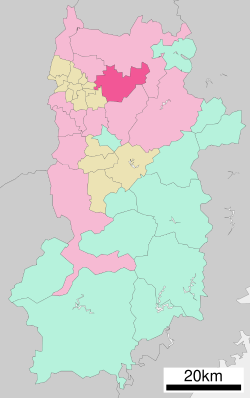 Location of Tenri in Nara Prefecture | |
 Tenri Location in Japan | |
| Coordinates: 34°36′N 135°50′E / 34.600°N 135.833°E / 34.600; 135.833Coordinates: 34°36′N 135°50′E / 34.600°N 135.833°E / 34.600; 135.833 | |
| Country | Japan |
| Region | Kansai |
| Prefecture | Nara Prefecture |
| Government | |
| • Mayor | Keisaku Minami |
| Area | |
| • Total | 86.37 km2 (33.35 sq mi) |
| Population (April 1, 2015) | |
| • Total | 66,866 |
| Symbols | |
| • Tree | Ginkgo |
| • Flower | Ume |
| Time zone | UTC+9 (JST) |
| City hall address | 605 Kawaharajō-chō, Tenri-shi, Nara-ken |
| Website | www.city.tenri.nara.jp |
Tenri (天理市, Tenri-shi) is a city located in Nara Prefecture, Japan. The modern city was founded on April 1, 1954, and is named after the Japanese new religion Tenrikyo, which has its headquarters in the city.
As of April 1, 2015, the city has an estimate population of 66,866, and 29,169 households.[1] The population density is 800.61 persons per km², and the total area is 86.37 km².[citation needed]
Contents
1 History
2 Education
3 Shrines and temples
3.1 Tenrikyo
3.2 Shinto
4 Transportation
4.1 Rail
4.2 Road
5 Sister cities
6 References
7 External links
History
Tenri was briefly the capital of Japan during the reign of Emperor Ninken.[2] The life of the Imperial court was centered at Isonokami Hirotaka Palace where the emperor lived in 488–498.[3]
Education
Primary schools
- Senzai Elementary School
- Idodo Elementary School
- Yamanobe Elementary School
- Nikaido Elementary School
- Tenri Elementary School (Private School)
- Yanagimoto Elementary School
- Tanbaichi Elementary School
- Ichinomoto Elementary School
- Fukuzumi Elementary School
- Asawa Elementary School
Junior high schools
- Kita Junior High School
- Minami Junior High School
- Fukuzumi Junior High School
- Nishi Junior High School
- Tenri Junior High School (Private School)
High schools
- Soekami High School
- Nikaido High School
- Tenri High School (Private School)
- Tenri Kyoko Gakuen High School[4]
Universities
- Tenri University
Shrines and temples
@media all and (max-width:720px){.mw-parser-output .mobile-float-reset{float:none!important;width:100%!important}}.mw-parser-output .stack-container{box-sizing:border-box}.mw-parser-output .stack-clear-left{float:left;clear:left}.mw-parser-output .stack-clear-right{float:right;clear:right}.mw-parser-output .stack-left{float:left}.mw-parser-output .stack-right{float:right}.mw-parser-output .stack-object{margin:1px;overflow:hidden}

Tenrikyo
- Tenrikyo Church Headquarters
Shinto
- Isonokami Shrine
Transportation
Rail
The central station of Tenri is Tenri Station.
West Japan Railway Company
Sakurai Line (Manyō-Mahoroba Line): Ichinomoto Station - Tenri Station - Nagara Station - Yanagimoto Station
Kintetsu Railway
Tenri Line: Nikaidō Station - Senzai Station - Tenri Station
Road
Expressways of Japan
- Nishi-Meihan Expressway
- Keinawa Expressway
 Japan National Route 24
 Japan National Route 25
 Japan National Route 169
Sister cities
 Bauru, Brazil
 La Serena, Chile
 Seosan, South Korea
References
^ "市町村別推計人口・世帯数". Nara Prefecture. April 1, 2015. Archived from the original on May 18, 2015. Retrieved May 5, 2015..mw-parser-output cite.citation{font-style:inherit}.mw-parser-output .citation q{quotes:"""""""'""'"}.mw-parser-output .citation .cs1-lock-free a{background:url("//upload.wikimedia.org/wikipedia/commons/thumb/6/65/Lock-green.svg/9px-Lock-green.svg.png")no-repeat;background-position:right .1em center}.mw-parser-output .citation .cs1-lock-limited a,.mw-parser-output .citation .cs1-lock-registration a{background:url("//upload.wikimedia.org/wikipedia/commons/thumb/d/d6/Lock-gray-alt-2.svg/9px-Lock-gray-alt-2.svg.png")no-repeat;background-position:right .1em center}.mw-parser-output .citation .cs1-lock-subscription a{background:url("//upload.wikimedia.org/wikipedia/commons/thumb/a/aa/Lock-red-alt-2.svg/9px-Lock-red-alt-2.svg.png")no-repeat;background-position:right .1em center}.mw-parser-output .cs1-subscription,.mw-parser-output .cs1-registration{color:#555}.mw-parser-output .cs1-subscription span,.mw-parser-output .cs1-registration span{border-bottom:1px dotted;cursor:help}.mw-parser-output .cs1-ws-icon a{background:url("//upload.wikimedia.org/wikipedia/commons/thumb/4/4c/Wikisource-logo.svg/12px-Wikisource-logo.svg.png")no-repeat;background-position:right .1em center}.mw-parser-output code.cs1-code{color:inherit;background:inherit;border:inherit;padding:inherit}.mw-parser-output .cs1-hidden-error{display:none;font-size:100%}.mw-parser-output .cs1-visible-error{font-size:100%}.mw-parser-output .cs1-maint{display:none;color:#33aa33;margin-left:0.3em}.mw-parser-output .cs1-subscription,.mw-parser-output .cs1-registration,.mw-parser-output .cs1-format{font-size:95%}.mw-parser-output .cs1-kern-left,.mw-parser-output .cs1-kern-wl-left{padding-left:0.2em}.mw-parser-output .cs1-kern-right,.mw-parser-output .cs1-kern-wl-right{padding-right:0.2em}
^ Ponsonby-Fane. (1915). The Imperial Family of Japan, p. 15.
^ Koch, W. (1904). Japan; Geschichte nach japanischen Quellen und ethnographische Skizzen. Mit einem Stammbaum des Kaisers von Japan, p. 13.
^ "Tenri Kyoko Gakuen High School Website".
External links
 Media related to Tenri, Nara at Wikimedia Commons
 Geographic data related to Tenri, Nara at OpenStreetMap
Tenri City official website (in Japanese)
Nara (capital) | ||
| Core city |
| |
| Cities |
| |
| Districts |
| |
List of mergers in Nara Prefecture | ||
| People |
|
|---|---|
| Scriptures |
|
| Supplemental texts |
|
| Teachings |
|
| Prayers |
|
| History |
|
| Institutions |
|
| Other |
|
Authority control |
|
|---|
This Nara Prefecture location article is a stub. You can help Wikipedia by expanding it. |


