Thurrock
Thurrock Borough of Thurrock | |
|---|---|
Borough & Unitary authority area | |
 Lakeside Shopping Centre | |
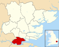 Shown within Essex | |
| Coordinates: 51°30′00″N 0°25′00″E / 51.50000°N 0.41667°E / 51.50000; 0.41667 | |
| Country | United Kingdom |
| Constituent country | England |
| Region | East |
| Ceremonial County | Essex |
| Government | |
| • Body | Thurrock Council |
| • Leadership | Leader & Cabinet[1] |
| • Executive | Conservative Administration, (Council NOC) |
| • MPs | Jackie Doyle-Price (C) Stephen Metcalfe (C) |
| • Leader of the Council | Cllr Robert Gledhill (C) |
| • Mayor of Thurrock | Cllr Tunde Ojetola (C) |
| Area | |
| • Total | 163.38 km2 (63.08 sq mi) |
| Population | |
| • Total | Ranked 111th 170,400 |
| • Density | 1,042/km2 (2,700/sq mi) |
| • Ethnicity[2] | 80.9% White British 4.9% Other White 3.8% Asian 7.8% Black 2.0% Mixed Race 0.6% other |
| Time zone | GMT |
| • Summer (DST) | British Summer Time |
| ONS code | 00KG (ONS) E06000034 (GSS) |
| Website | www.thurrock.gov.uk |
Thurrock (/ˈθʌrək/) is a unitary authority area with borough status in the English ceremonial county of Essex. It is part of the London commuter belt and an area of regeneration within the Thames Gateway redevelopment zone. The local authority is Thurrock Council.
Contents
1 The borough
1.1 Politics
1.2 Land use
1.3 Attractions
1.4 Thurrock in Bloom
2 History
2.1 Captain Kidd
2.2 1953 Floods
2.3 Heritage plaques
3 Culture and film
3.1 Art Deco architecture in Thurrock
4 Demographics
5 Education
5.1 Partnerships
6 Transport
7 Economy
8 Sport and leisure
9 List of places in the borough
9.1 Historic buildings
10 Climate
11 References
12 External links
The borough
It lies on the River Thames just to the east of London. With over 18 miles (29 km) of riverfront it covers an area of 64 square miles (170 km2), with more than half defined as Green Belt. With Greater London to the west and the river to the south, the county of Essex abuts the Borough to the north and east, and across the river lies Kent.
Politics
The local authority is Thurrock Council. Elections are held 3 out of every 4 years. In 2016, the Conservative Party took control of the council, albeit as a minority-party administration.
Thurrock is covered by two parliamentary constituencies. Thurrock includes most of the borough while South Basildon and East Thurrock includes some wards in the east of the borough. Both seats were Conservative gains from Labour at the 2010 general election.
The Council is led by Cllr Rob Gledhill (C) as of May 2016. The Mayor is Cllr Barbara Rice (L).
Land use
Thurrock has a population of 157,500[3] people living in 90,500 homes. The Metropolitan Green Belt covers 70% of the borough. There are 494 acres (200 ha) of land available for industrial use.[4] There are seven conservation areas, 19 scheduled ancient monuments, including the dovecote at High House Purfleet, and 239 listed buildings.
The borough contains ten sites of special scientific interest:
- Globe Pit, Grays
- Grays Chalk Pit
- Lion Pit, Grays
- Purfleet Chalk Pits
- West Thurrock Lagoon and Marshes
- Inner Thames Marshes
- Vange and Fobbing Marshes
- Basildon Meadows
- Mucking Flats and Marshes
Hangman's Wood and Deneholes
Despite much of the borough being protected Green Belt land, Thurrock provides localised opportunities for further industrial and commercial development. The borough forms part of the Thames Gateway regeneration area, a corridor of opportunity that has been identified by central government as the area with greatest development and commercial potential in the country. Thurrock Development Corporation took over much of the borough's planning functions from its creation in 2005 until its demise in March 2011.
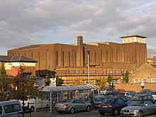
Much of the population and commercial activity is centred along the riverfront. This includes many large and important industrial sites, including two large oil refineries, manufacturing industries, a container port, cruise liner terminal, distribution warehousing and one of Britain's largest refuse disposal sites at the appropriately named settlement of Mucking. Thurrock is also home to the Lakeside Shopping Centre.
Attractions

The Dovecote at High House
There is one multiplex cinema attached to the Lakeside Shopping Centre, and the Thameside Theatre in Grays. Live shows are held at the Circus Tavern in Purfleet. Open space includes Chafford Gorges Nature Park, Langdon Hills Country Park and Grove House Wood, managed by Essex Wildlife Trust. Museums and historic buildings include Coalhouse Fort at East Tilbury, Tilbury Fort in Tilbury, Purfleet Heritage and Military Centre, High House, Purfleet with its historic farm buildings, the Royal Opera House's Bob and Tamar Manoukian Production Workshop, The Backstage Centre and ACME artists' studios, Thurrock Museum and Walton Hall Farm Museum.
Next to Lakeside Shopping Centre is Arena Essex, a motor sports complex, where speedway, banger and stock car racing takes place.
Thurrock in Bloom
Thurrock in Bloom is a voluntary group that works in partnership with Thurrock Council and co-sponsors such as Sandown Nursery and Elm Horticulture to promote floral displays. It is part of a more general "in bloom" initiative organised by the Royal Horticultural Society.[5] The Thurrock initiative includes an annual competition[6] and sponsorship of roundabouts.[7] Award winners include Woodside Primary School which has received silver and gold awards for its wildlife garden.
History
Mammoths once grazed in the Thurrock area[8] and archaeologists recently unearthed the remains of a jungle cat. Man has been in the area since prehistoric times[8] and the land has been farmed by the Romans[8] and Anglo-Saxons[8] Thurrock has numerous archaeological sites including the major excavation at Mucking.

The Woolmarket
Horndon-on-the-Hill was the site of an 11th century mint as well as the 15th century woolmarket which gives an indication of the area's wealth in the 15th century. The narrowing of the river where Tilbury now stands meant it was important in the defence of London, and Henry VIII built three blockhouses, two on the Tilbury side and another on the Gravesend side of the river, following the end of his marriage to Catherine of Aragon.
In 1381, villagers from Fobbing, Mucking and Stanford-le-Hope instigated the Peasant's Revolt when they were called to Brentwood to pay the poll tax. When they refused to pay, a riot ensued which was the catalyst for a mass protest across Essex and Kent.
Later, in 1588 Elizabeth I addressed her troops not far from the Tilbury blockhouse as the Spanish Armada sailed up the English Channel. Between 1670 and 1682, the Tilbury blockhouse was substantially rebuilt into a much larger fortification (Tilbury Fort) and Coalhouse Fort was built further down river, close to the second blockhouse. The importance of the forts in defending the country continued through Napoleonic times and into the two world wars. The land where Tilbury Town now stands was farmland and marsh grazing until the building of the docks in the 1890s. Thurrock includes the Bata village, built for workers of the shoe company in 1933. Eight homes and the factory are listed.
Historically, the area was renowned for mineral extraction, including clay, aggregates and notably the digging of huge amounts of chalk from the West Thurrock area for use in the now defunct cement industries. When chalk extraction ceased one of the disused pits was redeveloped as Lakeside Shopping Centre. A number of former pits have been used to form the Chafford Gorges Nature Reserve, managed by the Essex Wildlife Trust.[9]
The present-day borough of Thurrock was created in 1974 from the former area of Thurrock Urban District. The Local Government Act 1972 left the boundaries mostly untouched, although part of it, in Basildon New Town, was ceded to the Basildon district and the district gained borough status.[10]
It was given administrative independence from Essex County Council on 1 April 1998 by The Essex (Boroughs of Colchester, Southend-on-Sea and Thurrock and District of Tendring) (Structural, Boundary and Electoral Changes) Order 1996. It remains part of Essex for ceremonial purposes such as lord-lieutenancy.
Captain Kidd
The body of Captain Kidd was displayed in Thurrock. He had been convicted of piracy and hanged on 23 May 1701, at 'Execution Dock', Wapping. His body was gibbeted — left to hang in an iron cage over the Thames at Tilbury Point[11] — as a warning to future would-be pirates for twenty years. Some sources give the location that his body was exhibited as Tilbury Ness, but this may be an alternative name for the same place. There is some uncertainty as to whether his body was displayed at what is now called Coalhouse Point or at a site a few hundred yards up stream, close to the present Tilbury Docks.[12]
1953 Floods
On 31 January 1953, the low-lying areas of Thurrock were inundated by the North Sea flood of 1953. The Van den Berghs and Jurgens margarine factory, which manufactured Stork margarine, was forced to stop production for many months. Since the output of this factory constituted one third of the country's ration allocation, this led to a severe strain on the supply of margarine in the UK.[13] Most schools in Thurrock were closed, either as a direct result of the flooding or in order to use them to help the relief effort. More than 1300 people in Tilbury and other low-lying areas were evacuated to schools on the higher ground.[14] Chadwell St Mary Primary school was used as the main welfare centre for the homeless.[15] By 15 February, most schools had returned to normal. The last to resume were the Landsdowne school in Tilbury and the newly opened Woodside Primary School - then called Tyrell Heath School.[16] On Friday 13 February, the flooded areas were visited by the young Queen Elizabeth II[14] Despite severe loss of life in nearby Canvey Island, only one person in Thurrock died as a result of the floods.[17]
Heritage plaques
In 2002, a partnership between Thurrock Council, Thurrock Heritage Forum and the Thurrock Local History Society began an initiative to place heritage plaques marking the famous people, events and organisations associated with Thurrock.[18] By June 2013 there were plaques to:
- Joseph Conrad
- Alice Mangold Diehl (Musician and Novelist, born in Aveley)
Dracula's connection to Purfleet- The arrival of the Empire Windrush at Tilbury on 21 June 1948.
- The training ship Exmouth
- The Kynoch factory in the Corringham marshes
- The shooting down of Zeppelin L15 at Purfleet in 1916
- Philip Vincent
Alfred Russel Wallace and his house at the Dell
- Arthur Young
- The establishment of the town of Tilbury in 1912
John Newton's connection with Aveley and Purfleet
Benjamin Franklin's connection with the design of a lightning conductor for the Purfleet gunpowder magazine[19]
Henry de Grey who gave his name to Grays.[20]
Culture and film
Thurrock has been the scene of several major films.[21] St Clement's Church and street scenes at West Thurrock were used in the making of the film Four Weddings and a Funeral. Thurrock can also be seen in 28 Days Later. Scenes from the films Alfie (2004), and Indiana Jones and the Last Crusade were shot at Tilbury docks. The opening scenes from Batman Begins (2005) were shot at Coalhouse Fort in East Tilbury. Some filming also took place for the film Essex Boys in and around the Bata estate at East Tilbury. The State Cinema where Eddie met Roger in the classic Who Framed Roger Rabbit can be found in Grays.
Art Deco architecture in Thurrock
The State Cinema in 2007
There are a number of examples of Art Deco architecture in Thurrock. The baggage hall at Tilbury was opened in 1930. It has an art deco interior, designed by Sir Edwin Cooper and is a grade II listed building.[22] The State cinema is also a listed building and dates from 1938. It is one of the few surviving examples of 1930s cinema architecture. It has the original cinema organ which can still be played. However, in the early 21st century the building became disused and faced dereliction. In September 2015 it was announced that J D Wetherspoon had bought the property for conversion to a public house.[23] Building of the Bata Shoes estate in East Tilbury was begun in 1933 and this is now a conservation area.
Chadwell St Mary has one of the few examples of a "Sunspan" house designed by the architect Wells Coates. Although built in the 1950s, Woodside Primary School's architecture has been described as the slightly earlier "ocean liner" style of Art Deco. The building features a number of bricked curves and circular windows, while the wrought-iron banisters on the stairs are deliberately set to lean out at an angle.
Demographics
| Historical population | ||
|---|---|---|
| Year | Pop. | ±% |
| 1911 | 2,500 | — |
| 1951 | 82,100 | +3184.0% |
| 1961 | 114,300 | +39.2% |
| 1971 | 125,000 | +9.4% |
| 1981 | 127,400 | +1.9% |
| 1985 | 124,600 | −2.2% |
1991 | 128,700 | +3.3% |
| 1995 | 133,400 | +3.7% |
2001 | 143,300 | +7.4% |
| 2005 | 148,900 | +3.9% |
| 2007 | 152,200 | +2.2% |
2011 | 158,300 | +4.0% |
| All totals rounded to nearest hundred Source: Populstat & NOMIS | ||
At the census of 2011, there were 157,705 people, 62,353 households and 45,985 families residing in the borough. The population density was 9.7 people per hectare. There were 63,869 housing units. The racial makeup of the borough was 86% White, 3.8% Asian, 7.8% Black, 2% Mixed Race, 0.6% other.
There were 62,353 households out of which 30.5% had children under the age of 18 living with them, 72.7% were married couples living together, 52.5% of all households were made up of individuals, 10.2% had someone living alone who was 65 years of age or older.[24]
The median age in the borough was 42. 25.5% of residents were under the age of 18; 7.3% of residents were between the ages of 19 and 24; 30.3% were from 25 to 44; 24.2% were from 45 to 64; and 38.2% were 65 years of age or older. The gender makeup of the city was 49.3% male and 50.6% female.[24]
Education
Schools in Thurrock include the Ockendon Academy, Harris Academy Chafford Hundred, Gable Hall School, Gateway Academy, Grays Convent High School, William Edwards School & Sports College, Hathaway Academy, Deneholm Primary, Little Thurrock Primary, Quarry Hill Infant and Junior, St Thomas Of Canterbury Catholic Primary, Stifford Clays Infant and Junior, Stifford Primary, Thameside Infant and Junior School, Tudor Court Primary School, Warren Primary School, Chafford Hundred Primary School, Woodside Primary School (which was opened in 1952 as Tyrell's Infant and Junior Schools, the names being changed to avoid confusion with the neighbouring Torell's Secondary School; the schools were later amalgamated into one primary school) and Treetops School.
The local sixth form college is Palmer's College, whilst other colleges in Thurrock include South Essex College (Thurrock Campus) and Thurrock Adult Community College, and recently the Stanford and Corringham Sixth Form Centre was opened, as a joint sixth form college between Gable Hall School, Hassenbrook Specialist Technology College and St Clere's School.
Partnerships
The Tilbury and Chadwell St Mary Excellence Cluster.[25] brings together Chadwell St Mary Primary School, Corringham Primary School, Grays Convent High School, Hassenbrook Academy, Herringham Primary School, Landsdowne Primary School, Manor Infant School, Manor Junior School, St Mary's RC Primary School, Woodside Primary School and The Gateway Academy.
Senior members of the schools councils also sit on the cluster's student council.
Gable Hall School has had a long partnership with Pro Arte Alphen Park School in Pretoria, Gauteng, South Africa for almost 10 years - the two schools have held exchange programmes with each other and the students sampling life in each other's respective countries.
Woodside Primary is linked with a school in Nepal, through the charity Gorkha Learning for Life, which was founded by a member of school staff.[26]
Transport
National Rail in Thurrock | |||||||||||||||||||||||||||||||||||||||||||||||||||||||||||||||||||||||||||||
|---|---|---|---|---|---|---|---|---|---|---|---|---|---|---|---|---|---|---|---|---|---|---|---|---|---|---|---|---|---|---|---|---|---|---|---|---|---|---|---|---|---|---|---|---|---|---|---|---|---|---|---|---|---|---|---|---|---|---|---|---|---|---|---|---|---|---|---|---|---|---|---|---|---|---|---|---|---|
| |||||||||||||||||||||||||||||||||||||||||||||||||||||||||||||||||||||||||||||
Being both on the river and close to London, Thurrock is served with good communication links. The M25 London Orbital Motorway, the railway line between Southend and London Fenchurch Street which provides direct access to Central London and, eventually, Stratford International Station, the Port of Tilbury and the nearby London City Airport make Thurrock an important international trade centre. There is a grass airstrip south of Bulphan village. A ferry for passengers on foot connects Tilbury with Gravesend on the southern bank of the River Thames.
Rail transport in the borough is provided by c2c with stations at:
- Chafford Hundred railway station
- East Tilbury railway station
- Grays railway station
- Ockendon railway station
- Purfleet railway station
- Stanford-le-Hope railway station
- Tilbury Town railway station
West Horndon railway station (on northern boundary)
Bus services within the Thurrock urban area are mostly provided by Ensignbus.
- Arriva has a depot at West Thurrock, but all of its work is Transport for London contracts, and has only one route running into Thurrock.
Other operators are First, Stagecoach and Imperial bus co.
Economy
This is a chart of trend of regional gross value added of Thurrock at current basic prices published[27] (pp. 240–253) by Office for National Statistics with figures in millions of British Pounds Sterling.
| Year | Regional gross value added[28] | Agriculture[29] | Industry[30] | Services[31] |
|---|---|---|---|---|
| 1995 | 1,406 | 8 | 657 | 741 |
| 2000 | 1,737 | 4 | 677 | 1,056 |
| 2003 | 1,995 | 5 | 664 | 1,327 |
Sport and leisure
Thurrock has several Non-League football clubs in the area:
Thurrock F.C. who play at Ship Lane.
Aveley F.C. who play at Mill Field.
Grays Athletic F.C. who play at Rookery Hill.
East Thurrock United F.C. who play at Rookery Hill
Thurrock Yacht Club is based in the centre of Grays on the Thames foreshore, and offers a range of competitive and recreational boating opportunities.
List of places in the borough
- Aveley
- Bulphan
- Chadwell St Mary
- Chafford Hundred
- Corringham
- Coryton Refinery
- East Tilbury
- Fobbing
- Grays
- Horndon-on-the-Hill
- Little Thurrock
- Mucking
- Orsett
- Purfleet
- Shell Haven
- South Ockendon
- Stanford-le-Hope
- Stifford
- Thames Haven
- Thurrock Village
- Tilbury
- West Thurrock
Historic buildings
- Coalhouse Fort
- St Clement's Church
- The State Cinema
- Tilbury Fort
- The Woolmarket, Horndon
- Palmer's College
- Orsett Hall
Climate
Climate in this area has mild differences between highs and lows, and there is adequate rainfall year-round. The Köppen Climate Classification subtype for this climate is "Cfb" (Marine West Coast Climate/Oceanic climate).[32]
| Climate data for Thurrock | |||||||||||||
|---|---|---|---|---|---|---|---|---|---|---|---|---|---|
| Month | Jan | Feb | Mar | Apr | May | Jun | Jul | Aug | Sep | Oct | Nov | Dec | Year |
| Average high °C (°F) | 8 (46) | 8 (46) | 11 (52) | 12 (54) | 16 (61) | 18 (64) | 21 (70) | 22 (72) | 18 (64) | 14 (57) | 10 (50) | 8 (46) | 14 (57) |
| Average low °C (°F) | 5 (41) | 4 (39) | 6 (43) | 6 (43) | 10 (50) | 12 (54) | 15 (59) | 15 (59) | 12 (54) | 10 (50) | 6 (43) | 5 (41) | 9 (48) |
| Average precipitation days | 13 | 11 | 10 | 11 | 8 | 10 | 9 | 5 | 11 | 10 | 9 | 10 | 117 |
| Source: Weatherbase [33] | |||||||||||||
References
^ "The Cabinet and its members | Cabinet | Thurrock Council". www.thurrock.gov.uk..mw-parser-output cite.citation{font-style:inherit}.mw-parser-output .citation q{quotes:"""""""'""'"}.mw-parser-output .citation .cs1-lock-free a{background:url("//upload.wikimedia.org/wikipedia/commons/thumb/6/65/Lock-green.svg/9px-Lock-green.svg.png")no-repeat;background-position:right .1em center}.mw-parser-output .citation .cs1-lock-limited a,.mw-parser-output .citation .cs1-lock-registration a{background:url("//upload.wikimedia.org/wikipedia/commons/thumb/d/d6/Lock-gray-alt-2.svg/9px-Lock-gray-alt-2.svg.png")no-repeat;background-position:right .1em center}.mw-parser-output .citation .cs1-lock-subscription a{background:url("//upload.wikimedia.org/wikipedia/commons/thumb/a/aa/Lock-red-alt-2.svg/9px-Lock-red-alt-2.svg.png")no-repeat;background-position:right .1em center}.mw-parser-output .cs1-subscription,.mw-parser-output .cs1-registration{color:#555}.mw-parser-output .cs1-subscription span,.mw-parser-output .cs1-registration span{border-bottom:1px dotted;cursor:help}.mw-parser-output .cs1-ws-icon a{background:url("//upload.wikimedia.org/wikipedia/commons/thumb/4/4c/Wikisource-logo.svg/12px-Wikisource-logo.svg.png")no-repeat;background-position:right .1em center}.mw-parser-output code.cs1-code{color:inherit;background:inherit;border:inherit;padding:inherit}.mw-parser-output .cs1-hidden-error{display:none;font-size:100%}.mw-parser-output .cs1-visible-error{font-size:100%}.mw-parser-output .cs1-maint{display:none;color:#33aa33;margin-left:0.3em}.mw-parser-output .cs1-subscription,.mw-parser-output .cs1-registration,.mw-parser-output .cs1-format{font-size:95%}.mw-parser-output .cs1-kern-left,.mw-parser-output .cs1-kern-wl-left{padding-left:0.2em}.mw-parser-output .cs1-kern-right,.mw-parser-output .cs1-kern-wl-right{padding-right:0.2em}
^ Services, Good Stuff IT. "Thurrock - UK Census Data 2011". UK Census Data.
^ Neighbourhood Statistics. "Check Browser Settings". Neighbourhood.statistics.gov.uk. Retrieved 2013-07-05.
^ [1] Archived 29 October 2012 at the Wayback Machine
^ "Britain in Bloom". Archived from the original on 17 April 2010.
^ "Overview - Thurrock in Bloom - Thurrock Council". Archived from the original on 23 January 2010.
^ Roundabout sponsorship
^ abcd Catton, Jonathan, A Short History of Thurrock in Christopher Harrold, ed. (2008). Exploring Thurrock. Thurrock Local History Society.
^ "The Geology of Essex".
^ [2] Archived 5 December 2007 at the Wayback Machine
^ "Archived copy". Archived from the original on 12 June 2011. Retrieved 21 April 2010.CS1 maint: Archived copy as title (link)
^ "Captain Kidd - the Tilbury connection". Archived from the original on 8 June 2011.
^ Grieve, Hilda (1959). The Great Tide. Essex County Council. p. 466.
^ ab "1953 Floods". Archived from the original on 5 March 2010.
^ Grieve, 1959, page 600
^ Grieve, 1959, page 616
^ Grieve, 1959, page 568
^ "Thurrock Council".
^ Thurrock Yellow Advertiser, 26 April 2012
^ Reporter, Staff (14 June 2013). "Commemorating the Norman knight, Henry de Grey".
^ "Thurrock Heritage Fact File". Archived from the original on 8 June 2011.
^ Good Stuff. "Riverside Station (Including Floating Landing Stage) - Tilbury - Thurrock - England - British Listed Buildings".
^ "Pub chain JD Wetherspoon confirm purchase of State Cinema". Thurrock Gazette.
^ ab Neighbourhood Statistics. "Check Browser Settings". Neighbourhood.statistics.gov.uk. Retrieved 2013-07-05.
^ "Tilbury and Chadwell St Mary Excellence Cluster". Archived from the original on 30 April 2010.
^ "Gorkha Learning for Life". Archived from the original on 11 March 2010.
^ [3] Archived 28 July 2011 at the Wayback Machine
^ Components may not sum to totals due to rounding
^ includes hunting and forestry
^ includes energy and construction
^ includes financial intermediation services indirectly measured
^ "Thurrock, England Köppen Climate Classification (Weatherbase)". Weatherbase.
^
"Weatherbase.com". Weatherbase. 2013.
Retrieved on 5 July 2013.
External links
- Thurrock Borough Council
- Thurrock Gazette
- Thurrock Local History Society
| Unitary authorities |
|
|---|---|
| Boroughs or districts |
|
| Major settlements |
|
| Rivers |
|
| Topics |
|
| |
Districts of the East of England | ||
|---|---|---|
| Bedfordshire |
|  |
| Cambridgeshire |
| |
| Essex |
| |
| Hertfordshire |
| |
| Norfolk |
| |
| Suffolk |
| |
| Districts |
|  |
|---|---|---|
| Councils |
| |
| Local elections |
| |
Coordinates: 51°30′N 0°25′E / 51.500°N 0.417°E / 51.500; 0.417


