Toddington, Bedfordshire
| Toddington | |
|---|---|
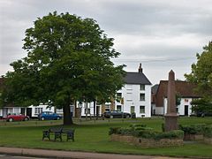 Toddington village green | |
| Population | 4,590 (2011 Census)[1] |
| OS grid reference | TL009289 |
| Civil parish |
|
| Unitary authority |
|
| Ceremonial county |
|
| Region |
|
| Country | England |
| Sovereign state | United Kingdom |
| Post town | DUNSTABLE |
| Postcode district | LU5 |
| Dialling code | 01525 |
| Police | Bedfordshire |
| Fire | Bedfordshire and Luton |
| Ambulance | East of England |
| EU Parliament | East of England |
| UK Parliament |
|
Toddington is a large village and civil parish in the county of Bedfordshire, England. It is situated 5 miles NNW of Luton, 4 miles (6 km) north of Dunstable, 6 miles (10 km) SW of Woburn, and 35 miles NNW of London on the A5120 and B579. It is 0.5 miles from Junction 12 of the M1 motorway and lends its name to the nearby motorway service station. The hamlet of Fancott also forms part of the Toddington civil parish.
Toddington is built around a large village green, around which sit the parish church and four of the village's six public houses. The Dunstable Northern Bypass taking heavy traffic bound for Dunstable from the M1 away from the village was delayed but a restart was announced in September 2011, now due to open in 2017.[2] A large-scale housebuilding programme has been proposed by the government for the environs of Luton, Dunstable and Milton Keynes, and proposals to build a 20,000 seat football stadium to replace Kenilworth Road were withdrawn in 2008.[citation needed]
Toddington has experienced a rise in house prices due to its reputation as a quiet English village and the easy commute into London.
For local government purposes it is in the Central Bedfordshire unitary authority, and is in the Mid-Bedfordshire parliamentary constituency, represented since 5 May 2005 by Conservative MP Nadine Dorries.
Contents
1 Amenities
2 Education
3 Geography
4 Other information
5 References
6 External links
Amenities
Toddington has four churches: Church of England (St George), Methodist, Baptist, and a Christian Fellowship.
It used to be claimed that Toddington had the most pubs per head of population of any village in the United Kingdom,[citation needed] although recently one has closed indefinitely and another was converted into a restaurant. The remaining pubs are: the Oddfellows Arms, the Angel, the Griffin,[3] the Bell, and the Fancott Arms (which lies about a mile outside the village centre).[4] The former pubs are the Nag's Head (which was demolished to make way for housing), the Sow and Pigs (closed in 2011 and converted into a dentist), the Red Lion (which turned into Ritzy Bar in 2011 but closed in 2014 and converted to housing in 2017) and the Bedford Arms (closed in February 2012 and awaiting reuse). The old town hall building was turned into a micropub, the Cuckoo, which opened in 2014.

St George's Church
Toddington has one theatre - Tads Theatre, on Conger Lane. It is owned and run by the charity group Tads Theatre, formerly known as the Toddington Amateur Dramatics Society. The group mounts 4-6 in-house productions each year, including an annual family pantomime.
Toddington has a brass band, the Toddington Town Band (TTB); it has existed in one form or another since 1856 and performs regularly at village events.
The nearest mainline railway station is Harlington, which is located in the nearby village of Harlington and is served by Thameslink. From Harlington there are trains north to Flitwick and Bedford, and south to Luton, Luton Airport Parkway, St Albans, St Pancras International, Gatwick Airport and Brighton. The Fancott Arms hosts the rideable miniature railway at Fancott.
Dropshort Marsh and Fancott Woods and Meadows, both close to the village, are managed as nature reserves by the Wildlife Trust for Bedfordshire, Cambridgeshire and Northamptonshire,[5][6] and each is designated a Site of Special Scientific Interest.[7][8][9]
There are several public rights of way within the parish and there are many walks[10] and rides around the village. The Icknield Way Path runs through the village on its 110-mile journey from Ivinghoe Beacon in Buckinghamshire to Knettishall Heath in Suffolk. The Icknield Way Trail, a multi-user route for walkers, horse riders and off-road cyclists, passes through the village.[11]
The village has several halls for use by the community. The largest hall is on Leighton Road and managed by the Toddington Village Hall Association[12] on behalf of the community.
Education
The village is served by two schools, Toddington St George Church of England School[13] and Parkfields Middle School,[14] which provide education for children aged between 4 and 13 years of age. After year 8, children transfer to Harlington Upper School located in nearby Harlington.
Geography
Toddington is situated on a chalky plateau, Totternhoe Stone, which rises up to 100 ft above the other Mid-Bedfordshire villages (e.g. Westoning, Harlington, Flitwick).
Other information
Toddington Castle was a timber motte-and-bailey castle built before the 13th century in Toddington. Today only earthworks remain of the castle, known as Conger Hill. Chalgrave Castle was built to the south of the village during the 11th century, however no visible remains of the structure exist today.
Elizabeth I is reputed to have stayed in Toddington Manor.[citation needed]William Blake is said to have drunk at the Angel.[citation needed]
The child actor Jack Wild is buried in the parish cemetery.
References
^ "Civil Parish population 2011". Neighbourhood Statistics. Office for National Statistics. Retrieved 12 November 2016..mw-parser-output cite.citation{font-style:inherit}.mw-parser-output .citation q{quotes:"""""""'""'"}.mw-parser-output .citation .cs1-lock-free a{background:url("//upload.wikimedia.org/wikipedia/commons/thumb/6/65/Lock-green.svg/9px-Lock-green.svg.png")no-repeat;background-position:right .1em center}.mw-parser-output .citation .cs1-lock-limited a,.mw-parser-output .citation .cs1-lock-registration a{background:url("//upload.wikimedia.org/wikipedia/commons/thumb/d/d6/Lock-gray-alt-2.svg/9px-Lock-gray-alt-2.svg.png")no-repeat;background-position:right .1em center}.mw-parser-output .citation .cs1-lock-subscription a{background:url("//upload.wikimedia.org/wikipedia/commons/thumb/a/aa/Lock-red-alt-2.svg/9px-Lock-red-alt-2.svg.png")no-repeat;background-position:right .1em center}.mw-parser-output .cs1-subscription,.mw-parser-output .cs1-registration{color:#555}.mw-parser-output .cs1-subscription span,.mw-parser-output .cs1-registration span{border-bottom:1px dotted;cursor:help}.mw-parser-output .cs1-ws-icon a{background:url("//upload.wikimedia.org/wikipedia/commons/thumb/4/4c/Wikisource-logo.svg/12px-Wikisource-logo.svg.png")no-repeat;background-position:right .1em center}.mw-parser-output code.cs1-code{color:inherit;background:inherit;border:inherit;padding:inherit}.mw-parser-output .cs1-hidden-error{display:none;font-size:100%}.mw-parser-output .cs1-visible-error{font-size:100%}.mw-parser-output .cs1-maint{display:none;color:#33aa33;margin-left:0.3em}.mw-parser-output .cs1-subscription,.mw-parser-output .cs1-registration,.mw-parser-output .cs1-format{font-size:95%}.mw-parser-output .cs1-kern-left,.mw-parser-output .cs1-kern-wl-left{padding-left:0.2em}.mw-parser-output .cs1-kern-right,.mw-parser-output .cs1-kern-wl-right{padding-right:0.2em}
^ "Improvements and major road projects | A5 to M1 link (Dunstable northern bypass)". roads.highways.gov.uk. Retrieved 2017-01-01.
^ The Griffin
^ The Fancott
^ "Dropshort Marsh". Wildlife Trust for Bedfordshire, Cambridgeshire and Northamptonshire. Retrieved 25 August 2015.
^ "Fancott Woods and Meadows". Wildlife Trust for Bedfordshire, Cambridgeshire and Northamptonshire. Retrieved 25 August 2015.
^ "Dropshort Marsh citation" (PDF). Sites of Special Scientific Interest. Natural England. Retrieved 25 August 2015.
^ "Map of Dropshort Marsh". Sites of Special Scientific Interest. Natural England. Retrieved 25 August 2015.
^ "Fancott Woods and Meadows citation" (PDF). Sites of Special Scientific Interest. Natural England. Retrieved 25 August 2015.
^ "Toddington.Info". www.toddington.info. Retrieved 2017-01-01.
^ "The Icknield Way Trail". Retrieved 1 January 2017.
^ "Toddington Village Hall". Retrieved 12 February 2017.
^ St George School
^ Parkfields School
External links
| Wikimedia Commons has media related to Toddington, Bedfordshire. |
- Toddington Parish Council
- Toddington Residents Association
Coordinates: 51°56′58.57″N 0°31′56.28″W / 51.9496028°N 0.5323000°W / 51.9496028; -0.5323000


