Clearfield, Pennsylvania
Clearfield, Pennsylvania | |
|---|---|
Borough | |
 Clearfield, Pennsylvania, looking west | |
 Location of Clearfield in Clearfield County, Pennsylvania. | |
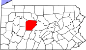 Map showing Clearfield County in Pennsylvania | |
 Clearfield Pennsylvania Show map of Pennsylvania  Clearfield Clearfield (the US) Show map of the US | |
| Coordinates: 41°01′21″N 78°26′25″W / 41.02250°N 78.44028°W / 41.02250; -78.44028Coordinates: 41°01′21″N 78°26′25″W / 41.02250°N 78.44028°W / 41.02250; -78.44028 | |
| Country | United States |
| State | Pennsylvania |
| County | Clearfield |
| Settled | 1805 |
| Incorporated | 1840 |
| Government | |
| • Type | Borough Council |
| • Mayor | James P. Schell |
| Area [1] | |
| • Total | 1.88 sq mi (4.87 km2) |
| • Land | 1.80 sq mi (4.67 km2) |
| • Water | 0.08 sq mi (0.20 km2) |
| Elevation | 1,109 ft (338 m) |
| Population (2010) | |
| • Total | 6,215 |
| • Estimate (2016)[2] | 5,976 |
| • Density | 3,314.48/sq mi (1,279.87/km2) |
| Time zone | UTC-5 (Eastern (EST)) |
| • Summer (DST) | UTC-4 (EDT) |
| ZIP code | 16830 |
| Area code(s) | 814 |
| FIPS code | 42-14064 |
| Website | clearfieldboro.com |
Clearfield is a borough and the county seat[3] of Clearfield County, Pennsylvania, United States. As of the 2010 census the population was 6,215 people[4] making it the second most populous community in Clearfield County behind DuBois. The borough is part of the DuBois, PA Micropolitan Statistical Area, as well as the larger State College-DuBois, PA Combined Statistical Area. The settled area surrounding the borough consists of the nearby census-designated places of Hyde and Plymptonville, which combined with Clearfield have a population of approximately 8,595 people.
Contents
1 Consolidation
2 History
3 National Register of Historic Places
4 All-America City
5 Geography
5.1 Adjacent counties
6 Neighborhoods
7 Schools
8 Libraries
9 Demographics
10 Notable people
11 Media
11.1 Television
11.2 Movies
12 Newspaper
13 Radio
14 See also
15 References
16 External links
Consolidation
As of October 2015, meetings between Clearfield Borough and Lawrence Township members have been discussed for possible merger and consolidation of the two municipalities to become one municipality or city. As of October 1, 2016 both Clearfield Borough and Lawrence Township still remain separate municipalities.[5][6] However meetings as of September 29, 2016 show the process is moving forward, and consolidation would occur around January 6, 2020 if vote passes.[7]
Location of the new municipality in Clearfield County if the vote passes in 2020.
History
There were many trade routes and paths for Native Americans living and passing through Clearfield County up to the 1600s. One major Indian path at the time was the Great Shamokin Path, which started near the Indian village of Shamokin (now Sunbury) on the Susquehanna River and continued west past Lock Haven, to Chinklacamoose,[8] now the borough of Clearfield. Finally the path ended at the village of Kittanning on the Allegheny River, which is now the modern town of the same name.
National Register of Historic Places
Clearfield is home to four of Clearfield County's list of twenty National Registered Historic Places.
- Clearfield County Courthouse
- Dimeling Hotel
- Old Town Historic District
- Thomas Murray House
Clearfield County Courthouse

Dimeling Hotel
Downtown center Clearfield South 2nd Street and Market Street
All-America City
In 1966, Clearfield was one of the winners of the All-America City Award, given annually to the top ten cities in the United States. The other nine cities included in the top ten list in 1966 were Pinellas County, Florida; Malden, Massachusetts; Ann Arbor, Michigan; Detroit, Michigan; Cohoes, New York; Greensboro, North Carolina; Richmond, Virginia; and Seattle, Washington.[9]
Geography
Clearfield is located near the center of Clearfield County along the West Branch of the Susquehanna River. Clearfield Creek joins the West Branch 2 miles (3 km) to the east (downstream) of town.
U.S. Route 322 passes through the borough, and Interstate 80 passes just to the north, with access from Exit 120 (Pennsylvania Route 879). Via US-322 and I-80 it is 22 miles (35 km) northwest to the city of DuBois. US-322 leads southeast 40 miles (64 km) to State College.
Adjacent counties
Elk County (North)
Cameron County (Northeast)
Clinton County (Northeast)
Cambria County (South)
Blair County (Southeast)
Indiana County (Southwest)
Centre County (East)
Jefferson County (West)
Neighborhoods
East End is a neighborhood within the borough of Clearfield. The area is located in the northeastern portion of the borough. The northern portion of East End is U.S. Route 322. The southern part is made up of Woodland Road and Cemetery Road ending at the old Hillcrest Cemetery.[10]Denny's Beer Barrel is a pub located at the eastern tip of the neighborhood near US 322. The former Bionol ethanol plant, now a grain processing plant, is in the East End. Just to the north of the plant is the Pennsylvania Lines Headquarters of the R.J. Corman Railroad.[11]
Golden Rod, sometimes referred to as Golden Rod Farms, is located along U.S. 322 to the east about a mile from Clearfield and very close to Lock Haven University of Pennsylvania Clearfield Campus, and is not with the borough boundary. The neighborhood is near the confluence of the West Branch of the Susquehanna River and Clearfield Creek. The Clearfield Mall as well as Dairy Queen are located between East End and Golden Rod.
Hillsdale is located to the east of Clearfield, just outside the borough limits. The neighborhood is on a hill overlooking the borough. The boundary for this area is roughly from High Street (the borough boundary) to the west, to the Hillcrest Cemetery to the north, to Pennsylvania Route 879 to the east. Lock Haven University's[12] Clearfield branch campus was once located in Hillsdale, but relocated to its current location along U.S. Route 322, about 2 miles (3 km) east of downtown.
Kerr or more commonly known as Kerr Addition is located outside the borough limits on the north side of the West Branch Susquehanna River when the river makes a turn to the east. It is across the river from the East End neighborhood. The Clearfield County Career and Technology Center is located in Kerr Addition as well as the major businesses of Big Lots, Tractor Supply Co., Rural King and Save-A-Lot. Kerr Addition is east of the census-designated place of Plymptonville.
South Park or sometimes South Side is located mainly in the southern portion of the borough of Clearfield. It covers an area from the east bank of the West Branch of the Susquehanna River to Pennsylvania Route 879 to the south and east, and to Pennsylvania Route 153 to the north. Many old smaller mansion-style houses are located in the neighborhood which overlooks the river.
West Side is located inside the borough boundary to the west of the West Branch Susquehanna River, north to U.S. Route 322. It is made up of many mid 19th-century homes, and it is the location of many businesses and churches, some of which use "West Side" in their names. One of the bigger churches, West Side United Methodist Church[13] is located in the neighborhood. Clearfield Hospital is in the West Side near the northern boundary of the borough. The Clearfield County Fair, one of the biggest events in Pennsylvania, occurs at the Clearfield County Fairgrounds, located in this area within the borough limits.
Schools
Clearfield Area School District
- Clearfield Area Elementary School
- Clearfield Area Junior/Senior High School
- Clearfield Alliance Christian School
- St. Francis School
Libraries
- Joseph and Elizabeth Shaw Public Library
Demographics
| Historical population | |||
|---|---|---|---|
| Census | Pop. | %± | |
| 1850 | 503 | — | |
| 1860 | 757 | 50.5% | |
| 1870 | 1,361 | 79.8% | |
| 1880 | 1,809 | 32.9% | |
| 1890 | 2,248 | 24.3% | |
| 1900 | 5,081 | 126.0% | |
| 1910 | 6,851 | 34.8% | |
| 1920 | 8,529 | 24.5% | |
| 1930 | 9,221 | 8.1% | |
| 1940 | 9,372 | 1.6% | |
| 1950 | 9,357 | −0.2% | |
| 1960 | 9,270 | −0.9% | |
| 1970 | 8,176 | −11.8% | |
| 1980 | 7,580 | −7.3% | |
| 1990 | 6,633 | −12.5% | |
| 2000 | 6,631 | 0.0% | |
| 2010 | 6,215 | −6.3% | |
| Est. 2016 | 5,976 | [2] | −3.8% |
| Sources:[14][15][16] | |||
As of the census[15] of 2010, there were 6,215 people, a drop of 6.3% from the 2000 census.3,070 households, and 1,740 families residing in the borough. The population density was 3,649.7 people per square mile (1,406.7/km2). There were 3,326 housing units at an average density of 1,830.6 per square mile (705.6/km2). The racial makeup of the borough was 93.1% White, 2.6% African American, 0.08% Native American, 1.6% Asian, 0.06% from other races, and 0.9% from two or more races. Hispanic or Latino of any race were 1.4% of the population.
There were 3,070 households, out of which 24.5% had children under the age of 18 living with them, 42.4% were married couples living together, 10.4% had a female householder with no husband present, and 43.3% were non-families. 38.5% of all households were made up of individuals, and 17.2% had someone living alone who was 65 years of age or older. The average household size was 2.13 and the average family size was 2.83.
In the borough the population was spread out, with 20.4% under the age of 18, 8.4% from 18 to 24, 28.3% from 25 to 44, 22.7% from 45 to 64, and 20.2% who were 65 years of age or older. The median age was 41 years. For every 100 females there were 89.6 males. For every 100 females age 18 and over, there were 84.9 males.
The median income for a household in the borough was $27,414, and the median income for a family was $40,095. Males had a median income of $29,972 versus $22,607 for females. The per capita income for the borough was $17,374. About 8.3% of families and 13.4% of the population were below the poverty line, including 14.6% of those under age 18 and 15.4% of those age 65 or over.
According to the United States Census Bureau, the borough has a total area of 1.9 square miles (4.9 km2), of which, 1.8 square miles (4.7 km2) of it is land and 0.1 square miles (0.26 km2) of it (3.70%) is water.
Notable people
Willie Adams, major league baseball pitcher (1912-1919)
Howie Bedell, major league baseball player
William Bigler (January 1, 1814 – August 9, 1880), American politician, 12th Governor of Pennsylvania from 1852 to 1855, later U.S. Senator for Pennsylvania from 1856 until 1861.
William A. Wallace, Democratic U.S. senator who served from 1875–81
Powell Weaver, composer and organist
Earl Caldwell, former reporter and columnist for The New York Times; first African-American to have a regular column in a major national newspaper. Central figure in a major Supreme Court case about the protection of journalists' sources. Currently hosts Pacifica's WBAI radio (New York City)
Otto Eppers, cartoonist/illustrator who as part of a stunt successfully jumped off the Brooklyn Bridge at 17 years of age
Howard Fargo, former member of the Pennsylvania House of Representatives (1981-2000)
Rembrandt Cecil Robinson (1924-1972) was a United States Navy officer (Rear admiral)[17]
Edward Scofield, governor of Wisconsin (1897–1901)
William Irvin Swoope, Republican member of the U.S. House of Representatives (1923–27)
Anthony A. Mitchell, clarinetist, composer and conductor. Led the United States Navy Band from 1962-1968.
Media
Television
Clearfield receives television programming from the Johnstown-Altoona-State College, Pennsylvania media market.
Movies
Two feature films were shot on location in Clearfield County and downtown Clearfield by native Spencer T. Folmar. Once in 2009 for the feature film, "Guilt & Sentence" (2010), and again in 2016 for the upcoming feature film "Generational Sins" (2017) starring the Australian actor, Daniel MacPherson.
Newspaper
Clearfield is covered by The Progress, published daily since 1913, and Gant Daily, published online since 2006.
Radio
WOKW 102.9- Out of Curwensville,PA (Offices located in Clearfield, PA)
WPQP/WIFT/WCPA-AM (900)WQQP(95.9)DuBois, PA
See also
- Denny's Beer Barrel
References
^ "2016 U.S. Gazetteer Files". United States Census Bureau. Retrieved Aug 13, 2017..mw-parser-output cite.citation{font-style:inherit}.mw-parser-output q{quotes:"""""""'""'"}.mw-parser-output code.cs1-code{color:inherit;background:inherit;border:inherit;padding:inherit}.mw-parser-output .cs1-lock-free a{background:url("//upload.wikimedia.org/wikipedia/commons/thumb/6/65/Lock-green.svg/9px-Lock-green.svg.png")no-repeat;background-position:right .1em center}.mw-parser-output .cs1-lock-limited a,.mw-parser-output .cs1-lock-registration a{background:url("//upload.wikimedia.org/wikipedia/commons/thumb/d/d6/Lock-gray-alt-2.svg/9px-Lock-gray-alt-2.svg.png")no-repeat;background-position:right .1em center}.mw-parser-output .cs1-lock-subscription a{background:url("//upload.wikimedia.org/wikipedia/commons/thumb/a/aa/Lock-red-alt-2.svg/9px-Lock-red-alt-2.svg.png")no-repeat;background-position:right .1em center}.mw-parser-output .cs1-subscription,.mw-parser-output .cs1-registration{color:#555}.mw-parser-output .cs1-subscription span,.mw-parser-output .cs1-registration span{border-bottom:1px dotted;cursor:help}.mw-parser-output .cs1-hidden-error{display:none;font-size:100%}.mw-parser-output .cs1-visible-error{font-size:100%}.mw-parser-output .cs1-subscription,.mw-parser-output .cs1-registration,.mw-parser-output .cs1-format{font-size:95%}.mw-parser-output .cs1-kern-left,.mw-parser-output .cs1-kern-wl-left{padding-left:0.2em}.mw-parser-output .cs1-kern-right,.mw-parser-output .cs1-kern-wl-right{padding-right:0.2em}
^ ab "Population and Housing Unit Estimates". Retrieved June 9, 2017.
^ "Find a County". National Association of Counties. Archived from the original on 2011-05-31. Retrieved 2011-06-07.
^ "Geographic Identifiers: 2010 Census Summary File 1 (G001): Clearfield borough, Pennsylvania". U.S. Census Bureau, American Factfinder. Retrieved April 30, 2015.
^ http://clearfieldboro.com/consolidation/
^ http://gantdaily.com/2015/10/16/meeting-scheduled-to-discuss-clearfield-boroughlawrence-township-merger/
^ http://www.thecourierexpress.com/news/local/consolidation-committee-nearing-completion/article_ec4b7e8d-cc30-5d7c-bc11-4184e595b54c.html
^ History of Clearfield County, PA
^ https://www.nationalcivicleague.org/america-city-award/past-winners/
^ index
^ R. J. Corman Railroad Group
^ LHU Clearfield Campus
^ Home of West Side United Methodist Church, Clearfield PA 16830
^ "Census of Population and Housing". U.S. Census Bureau. Archived from the original on 12 May 2015. Retrieved 11 December 2013.
^ ab "American FactFinder". United States Census Bureau. Archived from the original on 2013-09-11. Retrieved 2008-01-31.
^ "Incorporated Places and Minor Civil Divisions Datasets: Subcounty Resident Population Estimates: April 1, 2010 to July 1, 2012". Population Estimates. U.S. Census Bureau. Archived from the original on 17 June 2013. Retrieved 11 December 2013.
^ "Rear Admiral R.C. Robinson". Retrieved 2014-04-21.
External links
| Wikimedia Commons has media related to Clearfield, Pennsylvania. |
 Clearfield, Pennsylvania travel guide from Wikivoyage
- Clearfield Borough official website
- History of Borough of Clearfield
Municipalities and communities of Clearfield County, Pennsylvania, United States | ||
|---|---|---|
County seat: Clearfield | ||
| City |
| |
| Boroughs |
| |
| Townships |
| |
| CDPs |
| |
| Unincorporated communities |
| |
| Footnotes | ‡This populated place also has portions in an adjacent county or counties | |


