Skopun
Skopun | |
|---|---|
Municipality and village | |
 | |
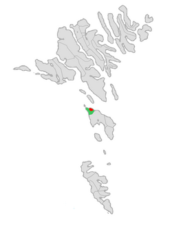 Location of Skopun Municipality in the Faroe Islands | |
 Skopun Location of Skopun village in the Faroe Islands | |
| Coordinates: 61°54′45″N 6°52′19″W / 61.91250°N 6.87194°W / 61.91250; -6.87194 | |
| State | |
| Constituent country | |
| Island | Sandoy |
| Municipality | Skopun Municipality |
| Founded | 1833 |
| Population (1 January 2006) | |
| • Total | 484 |
| Time zone | GMT |
| • Summer (DST) | UTC+1 (WEST) |
| Postal code | FO 240 |
| Climate | Cfc |
| Website | Skopun |
Skopun (pronounced [skopn]; Danish: Skopen) is a town in the Faroe Islands situated on the northern coast of Sandoy (Sand Island).
Skopun is the second-largest town on the island. Skopun Municipality consists only of the town of Skopun.
Contents
1 History
2 People from Skopun
3 See also
4 Gallery
5 References
6 External links
History
Although the area has been inhabited since the Middle Ages, Skopun was not founded until 1833.[1] The people of Skopun did not possess any land. They subsisted on fishing so the houses are close to the water.
In 1897, Skopun's church was constructed out of timber taken from the old church of Vestmanna. The Faroe Islands' first road was built on Sandoy in 1917,[2] as part of a government-financed plan to improve the island's non-existent harbour facilities. It connects Skopun with Sandur, the island's main town. Skopun's harbor was built in 1926 and later extended. In 1982, the harbor was furnished with a gate which protects the dock from the sea. A 1988 hurricane destroyed the town's small forest.
A car ferry used to connect Skopun with the capital, Tórshavn. Today, the ferry goes to the newly-constructed port of Gamlarætt, located on the south coast of Streymoy.
People from Skopun
Peter Mohr Dam, prime minister- Gerhard Lognberg, politician
Niels Winther Poulsen, educator and politician
Sakaris Stórá, film director
See also
- List of towns in the Faroe Islands
Gallery

The village of Skopun

View over Skopun

View from Skopun northwards over the Skopunarfjørður to Hestur
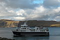
The ferry Teistin, connecting Sandoy with Streymoy calls at Skopun.


References
^ Wylie, Jonathan (1987). The Faroe Islands: Interpretations of History. The University Press of Kentucky. p. 120. ISBN 0-8131-1578-7..mw-parser-output cite.citation{font-style:inherit}.mw-parser-output q{quotes:"""""""'""'"}.mw-parser-output code.cs1-code{color:inherit;background:inherit;border:inherit;padding:inherit}.mw-parser-output .cs1-lock-free a{background:url("//upload.wikimedia.org/wikipedia/commons/thumb/6/65/Lock-green.svg/9px-Lock-green.svg.png")no-repeat;background-position:right .1em center}.mw-parser-output .cs1-lock-limited a,.mw-parser-output .cs1-lock-registration a{background:url("//upload.wikimedia.org/wikipedia/commons/thumb/d/d6/Lock-gray-alt-2.svg/9px-Lock-gray-alt-2.svg.png")no-repeat;background-position:right .1em center}.mw-parser-output .cs1-lock-subscription a{background:url("//upload.wikimedia.org/wikipedia/commons/thumb/a/aa/Lock-red-alt-2.svg/9px-Lock-red-alt-2.svg.png")no-repeat;background-position:right .1em center}.mw-parser-output .cs1-subscription,.mw-parser-output .cs1-registration{color:#555}.mw-parser-output .cs1-subscription span,.mw-parser-output .cs1-registration span{border-bottom:1px dotted;cursor:help}.mw-parser-output .cs1-hidden-error{display:none;font-size:100%}.mw-parser-output .cs1-visible-error{font-size:100%}.mw-parser-output .cs1-subscription,.mw-parser-output .cs1-registration,.mw-parser-output .cs1-format{font-size:95%}.mw-parser-output .cs1-kern-left,.mw-parser-output .cs1-kern-wl-left{padding-left:0.2em}.mw-parser-output .cs1-kern-right,.mw-parser-output .cs1-kern-wl-right{padding-right:0.2em}
^ Proctor, James (2008). Faroe Islands. Bradt Travel Guides. p. 136. ISBN 1-84162-224-9.
External links
| Wikimedia Commons has media related to Skopun. |
Skopun, information and pictures on Faroe Islands.dk
Maps, airports, & weather on Skopun, Faeroe Islands Page
Municipalities of the Faroe Islands | ||
|---|---|---|
|  | |
Coordinates: 61°54′45″N 6°52′19″W / 61.91250°N 6.87194°W / 61.91250; -6.87194


