Garbh Eilean, Loch Maree
Gaelic name | Garbh Eilean |
|---|---|
| Meaning of name | Rough Island |
| Location | |
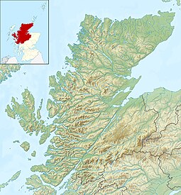  Garbh Eilean Garbh Eilean shown within Highland Scotland | |
| OS grid reference | NG911725 |
| Coordinates | 57°42′N 5°30′W / 57.7°N 5.5°W / 57.7; -5.5 |
| Physical geography | |
| Island group | Loch Maree |
| Area | 39 ha (96 acres)[1] |
| Area rank | (Freshwater: 9) [2] |
| Highest elevation | 25 m (82 ft) |
| Administration | |
| Sovereign state | United Kingdom |
| Country | Scotland |
| Council area | Highland |
| Demographics | |
| Population | 0 |
 | |
| References | [3][4] |
Garbh Eilean is a forested island in Loch Maree, Wester Ross, Scotland.

Garbh Eilean looking to Eilean Ruairidh Mòr
Garbh Eilean lies between Eilean Sùbhainn and Eilean Ruairidh Mòr. The islands are among the least disturbed in Britain. They are managed as the Loch Maree National Nature Reserve by agreements between Scottish Natural Heritage and their owners.[5]
Footnotes
^ Rick Livingstone’s Tables of the Islands of Scotland (pdf) Argyll Yacht Charters. Retrieved 12 Dec 2011.
^ Area and population ranks: there are c. 300 islands over 20 ha in extent and 93 permanently inhabited islands were listed in the 2011 census.
^ 2001 UK Census per List of islands of Scotland
^ Get-a-map (Map). Ordnance Survey..mw-parser-output cite.citation{font-style:inherit}.mw-parser-output .citation q{quotes:"""""""'""'"}.mw-parser-output .citation .cs1-lock-free a{background:url("//upload.wikimedia.org/wikipedia/commons/thumb/6/65/Lock-green.svg/9px-Lock-green.svg.png")no-repeat;background-position:right .1em center}.mw-parser-output .citation .cs1-lock-limited a,.mw-parser-output .citation .cs1-lock-registration a{background:url("//upload.wikimedia.org/wikipedia/commons/thumb/d/d6/Lock-gray-alt-2.svg/9px-Lock-gray-alt-2.svg.png")no-repeat;background-position:right .1em center}.mw-parser-output .citation .cs1-lock-subscription a{background:url("//upload.wikimedia.org/wikipedia/commons/thumb/a/aa/Lock-red-alt-2.svg/9px-Lock-red-alt-2.svg.png")no-repeat;background-position:right .1em center}.mw-parser-output .cs1-subscription,.mw-parser-output .cs1-registration{color:#555}.mw-parser-output .cs1-subscription span,.mw-parser-output .cs1-registration span{border-bottom:1px dotted;cursor:help}.mw-parser-output .cs1-ws-icon a{background:url("//upload.wikimedia.org/wikipedia/commons/thumb/4/4c/Wikisource-logo.svg/12px-Wikisource-logo.svg.png")no-repeat;background-position:right .1em center}.mw-parser-output code.cs1-code{color:inherit;background:inherit;border:inherit;padding:inherit}.mw-parser-output .cs1-hidden-error{display:none;font-size:100%}.mw-parser-output .cs1-visible-error{font-size:100%}.mw-parser-output .cs1-maint{display:none;color:#33aa33;margin-left:0.3em}.mw-parser-output .cs1-subscription,.mw-parser-output .cs1-registration,.mw-parser-output .cs1-format{font-size:95%}.mw-parser-output .cs1-kern-left,.mw-parser-output .cs1-kern-wl-left{padding-left:0.2em}.mw-parser-output .cs1-kern-right,.mw-parser-output .cs1-kern-wl-right{padding-right:0.2em}
^ "Loch Maree Islands National Nature Reserve". Scottish Natural Heritage. Retrieved 2007-12-14.
Islands of Scotland | |||||||||||||||||
|---|---|---|---|---|---|---|---|---|---|---|---|---|---|---|---|---|---|
|  | ||||||||||||||||
|
| |||||||||||||||||
| |||||||||||||||||
| |||||||||||||||||
| |||||||||||||||||
| |||||||||||||||||
| |||||||||||||||||
| |||||||||||||||||
Coordinates: 57°41.65′N 5°30.3′W / 57.69417°N 5.5050°W / 57.69417; -5.5050
 | This Highland location article is a stub. You can help Wikipedia by expanding it. |

