Noss
Norse name | Nos |
|---|---|
| Location | |
  Noss Noss shown within the Shetland Islands | |
| OS grid reference | HU544405 |
| Coordinates | 60°09′N 1°01′W / 60.15°N 1.02°W / 60.15; -1.02 |
| Physical geography | |
| Island group | Shetland |
| Area | 343 hectares (1.32 sq mi) |
| Area rank | 81 [1] |
| Highest elevation | 181 metres (594 ft) |
| Administration | |
| Sovereign state | United Kingdom |
| Country | Scotland |
| Council area | Shetland Islands |
| Demographics | |
| Population | 0 |
 | |
| References | [2][3] |
Noss or the Isle of Noss[4] is a small, previously inhabited island in Shetland, Scotland. It is a sheep farm and has been a national nature reserve since 1955.
Contents
1 Geography
2 Noss National Nature Reserve
2.1 Other designations
3 Gallery
4 References
5 External links
Geography
Noss is separated from the island of Bressay by the narrow Noss Sound. It has been run as a sheep farm since 1900.[3]
Noss had a population of 20 in 1851 but has had no permanent inhabitants since 1939. The main focus of settlement on Noss was around the low lying west side of the island at Gungstie (Old Norse: a landing place). Gungstie was built in the 1670s and is currently used by the seasonal wildlife wardens. Another settlement at Setter, on the south east of the island was inhabited until the 1870s and now lies derelict. Among the few families living on Noss were the Booth family headed by Joseph Booth (1765–1847). Genealogical records indicate that he was occupied as a farmer and fish curer. Records show that he was resident on Noss as early as 1834.[5]
Noss National Nature Reserve
Noss was designated a National Nature Reserve in 1955 [3] and is managed by Scottish Natural Heritage (SNH).The island is linked to Bressay by a seasonal ferry service, run by the wildlife wardens using an inflatable boat.
Noss is renowned for its seabird colonies and is one of the more accessible of the internationally important seabird colonies in the North Atlantic.[6] Attractions on Noss include a visitor centre, the Pony Pund built to breed Shetland ponies, the Holm of Noss rock and the Noup cliff. The sandstone cliffs of Noss have weathered into a series of horizontal ledges making ideal breeding grounds for gannets, puffins, guillemots, shags, black-legged kittiwakes, razorbills, fulmars and great skuas. Otters are also frequently seen around the island.
Other designations
As well as a National Nature Reserve, Noss also holds two other designations for its important wildlife, including:
Special Protection Area (SPA)
Site of Special Scientific Interest (SSSI)
Gallery
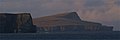
Noup of Noss and Noss Head

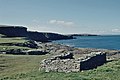
Pundsgeo



References
^ Area and population ranks: there are c. 300 islands over 20 ha in extent and 93 permanently inhabited islands were listed in the 2011 census.
^ Anderson, Joseph (Ed.) (1893) Orkneyinga Saga. Translated by Jón A. Hjaltalin & Gilbert Goudie. Edinburgh. James Thin and Mercat Press (1990 reprint). .mw-parser-output cite.citation{font-style:inherit}.mw-parser-output .citation q{quotes:"""""""'""'"}.mw-parser-output .citation .cs1-lock-free a{background:url("//upload.wikimedia.org/wikipedia/commons/thumb/6/65/Lock-green.svg/9px-Lock-green.svg.png")no-repeat;background-position:right .1em center}.mw-parser-output .citation .cs1-lock-limited a,.mw-parser-output .citation .cs1-lock-registration a{background:url("//upload.wikimedia.org/wikipedia/commons/thumb/d/d6/Lock-gray-alt-2.svg/9px-Lock-gray-alt-2.svg.png")no-repeat;background-position:right .1em center}.mw-parser-output .citation .cs1-lock-subscription a{background:url("//upload.wikimedia.org/wikipedia/commons/thumb/a/aa/Lock-red-alt-2.svg/9px-Lock-red-alt-2.svg.png")no-repeat;background-position:right .1em center}.mw-parser-output .cs1-subscription,.mw-parser-output .cs1-registration{color:#555}.mw-parser-output .cs1-subscription span,.mw-parser-output .cs1-registration span{border-bottom:1px dotted;cursor:help}.mw-parser-output .cs1-ws-icon a{background:url("//upload.wikimedia.org/wikipedia/commons/thumb/4/4c/Wikisource-logo.svg/12px-Wikisource-logo.svg.png")no-repeat;background-position:right .1em center}.mw-parser-output code.cs1-code{color:inherit;background:inherit;border:inherit;padding:inherit}.mw-parser-output .cs1-hidden-error{display:none;font-size:100%}.mw-parser-output .cs1-visible-error{font-size:100%}.mw-parser-output .cs1-maint{display:none;color:#33aa33;margin-left:0.3em}.mw-parser-output .cs1-subscription,.mw-parser-output .cs1-registration,.mw-parser-output .cs1-format{font-size:95%}.mw-parser-output .cs1-kern-left,.mw-parser-output .cs1-kern-wl-left{padding-left:0.2em}.mw-parser-output .cs1-kern-right,.mw-parser-output .cs1-kern-wl-right{padding-right:0.2em}
ISBN 0-901824-25-9
^ abc Haswell-Smith, Hamish (2004). The Scottish Islands. Edinburgh: Canongate. ISBN 978-1-84195-454-7.
^ "Isle of Noss". Ordnance Survey. Retrieved 7 February 2019.
^ Booth family on Shetland Island Genealogical Database
^ "The Story of Noss National Nature Reserve" (PDF) (2nd ed.). Scottish Natural Heritage. c. 2013. Retrieved 24 May 2017.
External links
Noss - Scotland's National Nature Reserves
 | Wikimedia Commons has media related to Isle of Noss. |
Shetland | ||
|---|---|---|
| Inhabited islands |
|  |
| Other islands |
| |
| Towns and villages |
| |
| Mainland Parishes |
| |
| Insular Parishes |
| |
| Maritime features |
| |
Extreme points
|
| |
| Topics |
| |
Islands of Scotland | |||||||||||||||||
|---|---|---|---|---|---|---|---|---|---|---|---|---|---|---|---|---|---|
|  | ||||||||||||||||
|
| |||||||||||||||||
| |||||||||||||||||
| |||||||||||||||||
| |||||||||||||||||
| |||||||||||||||||
| |||||||||||||||||
| |||||||||||||||||
Coordinates: 60°8′47″N 1°1′10″W / 60.14639°N 1.01944°W / 60.14639; -1.01944

